Difference between revisions of "2009-07-30 34 -84"
From Geohashing
imported>NWoodruff m (→Gallery) |
imported>NWoodruff m (→Gallery) |
||
| Line 28: | Line 28: | ||
Image:20090730_34_-84NW02.JPG| There is a walking trail that goes in the direction of the hash point. 0.2 of a mile to go. | Image:20090730_34_-84NW02.JPG| There is a walking trail that goes in the direction of the hash point. 0.2 of a mile to go. | ||
Image:20090730_34_-84NW03.JPG| Wading to the now island. 21.3 feet to go. | Image:20090730_34_-84NW03.JPG| Wading to the now island. 21.3 feet to go. | ||
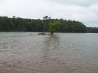
| − | Image:20090730_34_-84NW04.JPG| | + | Image:20090730_34_-84NW04.JPG| 2.06 feet to go. Close enough. |
Image:20090730_34_-84NW05.JPG| | Image:20090730_34_-84NW05.JPG| | ||
Image:20090730_34_-84NW06.JPG| | Image:20090730_34_-84NW06.JPG| | ||
Revision as of 20:14, 31 July 2009
| Thu 30 Jul 2009 in Roswell: 34.1572655, -84.6975680 geohashing.info google osm bing/os kml crox |
Graticule
About
People
Expeditions
Gallery
- Photo Gallery
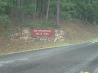
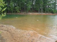
This hash point is in a beautiful state park.
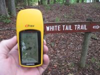
There is a walking trail that goes in the direction of the hash point. 0.2 of a mile to go.
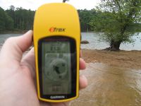
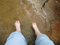
Wading to the now island. 21.3 feet to go.

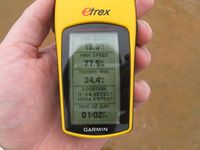
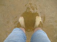
2.06 feet to go. Close enough.


Achievements
NWoodruff earned the Land geohash achievement
|