File:2009-10-23 51 -1 old map.png
From Geohashing

Size of this preview: 800 × 440 pixels. Other resolutions: 320 × 176 pixels | 1,054 × 580 pixels.
Original file (1,054 × 580 pixels, file size: 998 KB, MIME type: image/png)
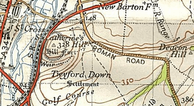
A map of the geohash location from about 50 years ago when there was no M3
See it on ooc.openstreetmap.org.
File history
Click on a date/time to view the file as it appeared at that time.
| Date/Time | Thumbnail | Dimensions | User | Comment | |
|---|---|---|---|---|---|
| current | 15:53, 30 January 2020 | | 1,054 × 580 (998 KB) | Maintenance script (talk | contribs) |
- You cannot overwrite this file.
File usage
The following page links to this file: