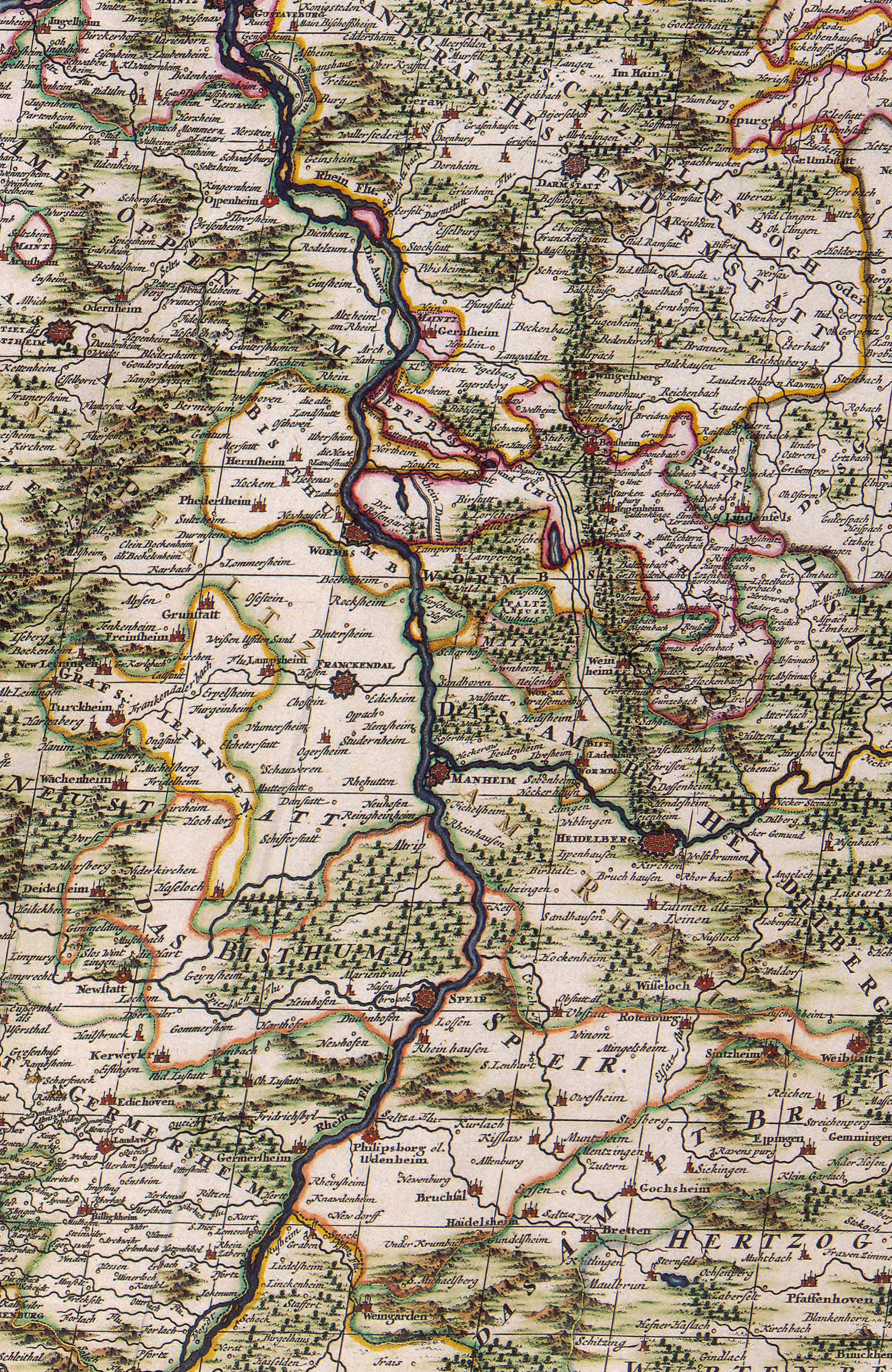
File:49 8 as of 1681.jpg
From Geohashing
Size of this preview: 390 × 600 pixels. Other resolutions: 156 × 240 pixels | 2,067 × 3,178 pixels.
Original file (2,067 × 3,178 pixels, file size: 4.32 MB, MIME type: image/jpeg)
You wouldn't believe I spent three hours aligning and skewing to find the best approximation to today's graticule borders. Surveying wasn't as accurate in 1681 as it became after 1822 (where a new method of triangulation was introduced) and, of course, by far not as accurate as it is today.
File history
Click on a date/time to view the file as it appeared at that time.
| Date/Time | Thumbnail | Dimensions | User | Comment | |
|---|---|---|---|---|---|
| current | 14:18, 30 January 2020 | | 2,067 × 3,178 (4.32 MB) | Maintenance script (talk | contribs) |
- You cannot overwrite this file.
File usage
The following page links to this file: