File:Hedge-end-recreation-ground.png
From Geohashing
No higher resolution available.
Hedge-end-recreation-ground.png (557 × 500 pixels, file size: 564 KB, MIME type: image/png)
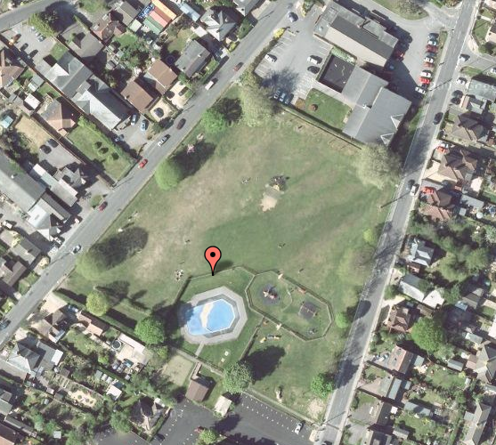
Map showing the XKCD location for 50 -1 on Sunday 28th June 2009. As you can see it's right in the middle of Hedge End recreation ground! :)
File history
Click on a date/time to view the file as it appeared at that time.
| Date/Time | Thumbnail | Dimensions | User | Comment | |
|---|---|---|---|---|---|
| current | 17:10, 30 January 2020 | | 557 × 500 (564 KB) | Maintenance script (talk | contribs) |
- You cannot overwrite this file.
File usage
The following page links to this file: