File:View from Hashpoint of Eureka Tower.JPG
From Geohashing
Size of this preview: 800 × 600 pixels. Other resolutions: 320 × 240 pixels | 1,024 × 768 pixels.
Original file (1,024 × 768 pixels, file size: 170 KB, MIME type: image/jpeg)
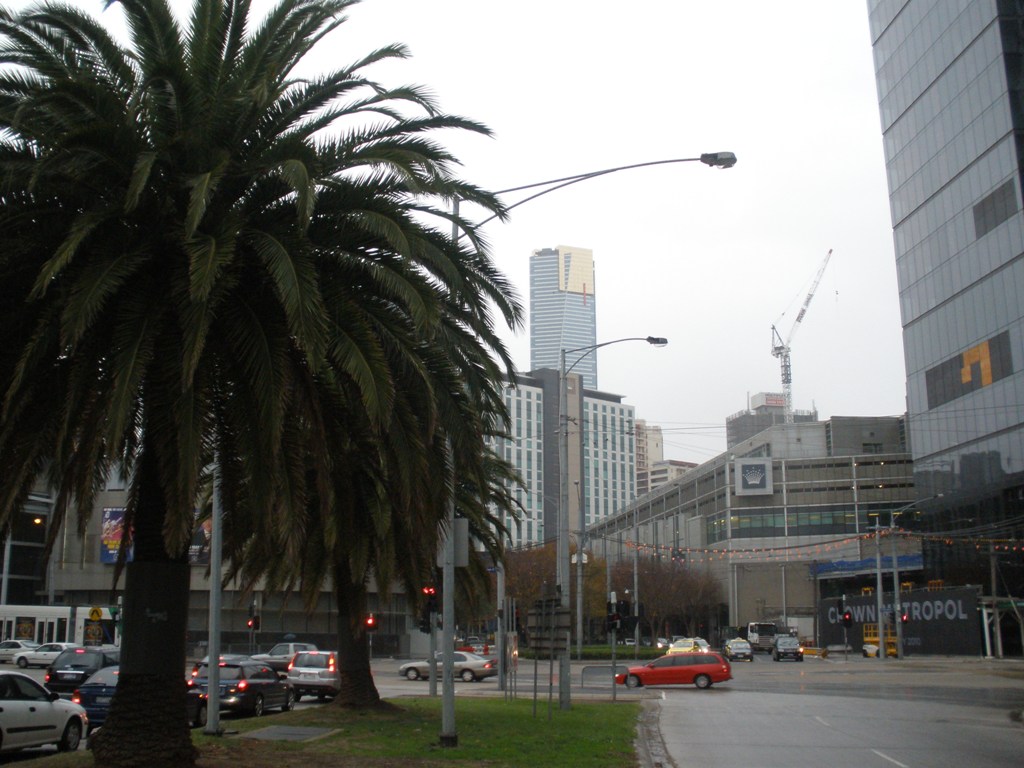
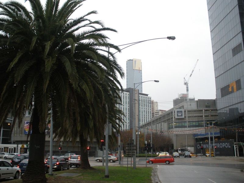
View from the geohash location on Monday, May the 25th, 2009. This view shows the Eureka Tower nearby, which is Australia's tallest building. The graticule is S37,E144 and was visited by Felix Dance during work hours (the location was within 500m of his place of work at a construction site). The location was in the centre median of Normanby Road, South Melbourne, Victoria, Australia.
File history
Click on a date/time to view the file as it appeared at that time.
| Date/Time | Thumbnail | Dimensions | User | Comment | |
|---|---|---|---|---|---|
| current | 15:55, 30 January 2020 | | 1,024 × 768 (170 KB) | Maintenance script (talk | contribs) |
- You cannot overwrite this file.
File usage
The following 5 pages link to this file: