Difference between revisions of "2011-07-23 66 25"
From Geohashing
imported>Isopekka |
imported>FippeBot m (Location) |
||
| (3 intermediate revisions by 3 users not shown) | |||
| Line 28: | Line 28: | ||
== Expedition == | == Expedition == | ||
| − | The hashpoint situated near the military area and near the airport of Rovaniemi, but not in restricted area. I had to walk from road 230 m to the hashpoint. And again the hash was in the forest... On the way to the hash I tasted delicious berries. One partridge flew away from my hashpath. | + | The hashpoint was situated near the military area and near the airport of Rovaniemi, |
| + | but not in restricted area. I had to walk from road 230 m to the hashpoint. And again | ||
| + | the hash was in the forest... On the way to the hash I tasted delicious berries. One | ||
| + | partridge flew away from my hashpath. | ||
| − | I could not get there at official meetup time because I had to construct new garden gates under the | + | I could not get there at the official meetup time because I had to construct new garden gates under the wife's severe control, and I couldn't escape. I was at the hash at 06:25 p.m. (Finnish summer time). |
* By car total 20 km | * By car total 20 km | ||
| Line 45: | Line 48: | ||
Image:IMG 2100.JPG| There it is, 230 m to walk. | Image:IMG 2100.JPG| There it is, 230 m to walk. | ||
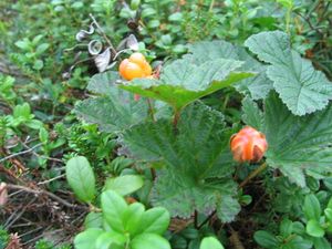
Image:Gh23072011 004.JPG| Cloudberries. | Image:Gh23072011 004.JPG| Cloudberries. | ||
| − | Image:Gh23072011 007.JPG| | + | Image:Gh23072011 007.JPG| Northern Bilberry. |
Image:Gh23072011 006.JPG| The Hash. | Image:Gh23072011 006.JPG| The Hash. | ||
Image:Gh23072011screen.jpg| The proof. | Image:Gh23072011screen.jpg| The proof. | ||
| − | |||
</gallery> | </gallery> | ||
| Line 75: | Line 77: | ||
[[Category:Expeditions]] | [[Category:Expeditions]] | ||
[[Category:Expeditions with photos]] | [[Category:Expeditions with photos]] | ||
| − | [[Category:Coordinates | + | [[Category:Coordinates reached]] |
| + | {{location|FI|10}} | ||
Latest revision as of 00:13, 13 August 2019
| Sat 23 Jul 2011 in 66,25: 66.5636684, 25.8014119 geohashing.info google osm bing/os kml crox |
Contents
Location
About 10 km to the NW from my home, in Someroharju, in the forest.
Participants
Expedition
The hashpoint was situated near the military area and near the airport of Rovaniemi, but not in restricted area. I had to walk from road 230 m to the hashpoint. And again the hash was in the forest... On the way to the hash I tasted delicious berries. One partridge flew away from my hashpath.
I could not get there at the official meetup time because I had to construct new garden gates under the wife's severe control, and I couldn't escape. I was at the hash at 06:25 p.m. (Finnish summer time).
- By car total 20 km
- Walking total 0.5 km
- Expedition took 0.5 h
- Physical effort (1-5): 2
Photos
Achievements
isopekka earned the Land geohash achievement
|
Geohashing Expeditions and Plans on This Day
Expeditions and Plans
| 2011-07-23 | ||
|---|---|---|
| Washington (West), District of Columbia | Someone went | in the middle of the road. |
| Portland, Oregon | Michael5000, Mrs.5000, Jennifer | Off of Springville Road, not far from Skyline Drive. |
| Bamberg, Germany | Mampfred, two dragalongs | Off a street on some grass land near Erlangen. |
| Yashkino, Russia | LemonadeCellar | A forest (presumably, the satellite image isn't exactly high-res, the only ... |
| Växjö, Sweden | Llavids | In the forest north of Urshult, Tingsryd, Småland, Sweden. |
| Rovaniemi, Finland | isopekka | About 10 km to the NW from my home, in Someroharju, in the forest. |


