Difference between revisions of "2013-03-23 50 10"
imported>Reinhard (create) |
imported>Reinhard (report) |
||
| Line 13: | Line 13: | ||
== Expedition == | == Expedition == | ||
| − | + | The actual mission of today was to take photos of me cycling up the [http://www.quaeldich.de/paesse/grosser-inselsberg/ Großer Inselsberg]. We planned this months ago and this weekend was the last opportunity for the photo shooting which we did for an article in a road bike magazine. Of course, we hoped for sunny spring weather, but let's see whether readers will like winter photos in a June issue. The road to the top looked very slippery due to snow and ice, so we had to be comfortable with a photo near our parking place at Kleiner Inselsberg. Manu had some companions for a winter walk to the top, but I was totally prepared for a bike ride and thus immediately broke away from the group and instantaneously froze my fingers, toes and face during the quick ride down to Tabarz due to the cold (something below -5°C) and humid airstream of up to 50 km/h. So after only 5 km I had my 1st of numerous breaks to revitalize my limbs. The trip back to Erfurt was 62 km including a short detour to this hashpoint which wasn't far from the destination. As bad as the outrageously low temperature at the end of March was the Siberian east-north-east wind, while I had to ride in ... guess what ... east-north-east direction - jackpot! Well, I got to Rehestädt in one not totally frozen piece and could start the 1 km struggle along a muddy field path to get very close to the hashpoint, which was on a fenced meadow (not totally closed) which obviously was intended for silly horse riding on the narrowest meadow one could find. Finding the exact spot, by the way, was straight forward this time and after some quick photos I looked for the shortest and least muddiest way to Thörey, from where it was only 14 km to Erfurt which I reached exactly when also Manu and the others came back from their Inselsberg visit by car. | |
== Photos == | == Photos == | ||
{{gallery|width=200|height=200|lines=2 | {{gallery|width=200|height=200|lines=2 | ||
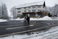
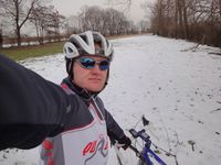
| − | |Image:20130323-50N10E-01.jpg| | + | |Image:20130323-50N10E-01.jpg|Departure at Kleiner Inselsberg. |
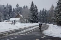
| − | |Image:20130323-50N10E-02.jpg| | + | |Image:20130323-50N10E-02.jpg|Mission One: Photo shooting. |
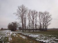
| − | |Image:20130323-50N10E-03.jpg| | + | |Image:20130323-50N10E-03.jpg|Hash meadow surrounded by tree rows. |
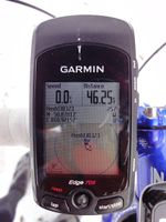
| − | |Image:20130323-50N10E-04.jpg| | + | |Image:20130323-50N10E-04.jpg|Coordinates reached. |
| − | |Image:20130323-50N10E-05.jpg| | + | |Image:20130323-50N10E-05.jpg|At the hash. |
}} | }} | ||
Revision as of 19:49, 23 March 2013
| Sat 23 Mar 2013 in 50,10: 50.8781701, 10.9215718 geohashing.info google osm bing/os kml crox |
Location
1 km north of Rehestädt on a meadow strip between fields.
Participants
Expedition
The actual mission of today was to take photos of me cycling up the Großer Inselsberg. We planned this months ago and this weekend was the last opportunity for the photo shooting which we did for an article in a road bike magazine. Of course, we hoped for sunny spring weather, but let's see whether readers will like winter photos in a June issue. The road to the top looked very slippery due to snow and ice, so we had to be comfortable with a photo near our parking place at Kleiner Inselsberg. Manu had some companions for a winter walk to the top, but I was totally prepared for a bike ride and thus immediately broke away from the group and instantaneously froze my fingers, toes and face during the quick ride down to Tabarz due to the cold (something below -5°C) and humid airstream of up to 50 km/h. So after only 5 km I had my 1st of numerous breaks to revitalize my limbs. The trip back to Erfurt was 62 km including a short detour to this hashpoint which wasn't far from the destination. As bad as the outrageously low temperature at the end of March was the Siberian east-north-east wind, while I had to ride in ... guess what ... east-north-east direction - jackpot! Well, I got to Rehestädt in one not totally frozen piece and could start the 1 km struggle along a muddy field path to get very close to the hashpoint, which was on a fenced meadow (not totally closed) which obviously was intended for silly horse riding on the narrowest meadow one could find. Finding the exact spot, by the way, was straight forward this time and after some quick photos I looked for the shortest and least muddiest way to Thörey, from where it was only 14 km to Erfurt which I reached exactly when also Manu and the others came back from their Inselsberg visit by car.
Photos
|
