Difference between revisions of "2017-03-20 66 25"
From Geohashing
imported>Isopekka |
imported>Isopekka |
||
| Line 71: | Line 71: | ||
| name = isopekka | | name = isopekka | ||
| + | }} | ||
| + | |||
| + | {{Last man standing | ||
| + | | latitude = 66 | ||
| + | | longitude = 25 | ||
| + | | date = 2017-03-20 | ||
| + | | gender = man | ||
| + | | name = Isopekka | ||
| + | |||
}} | }} | ||
Revision as of 07:15, 31 March 2017
| Mon 20 Mar 2017 in 66,25: 66.4824343, 25.8314003 geohashing.info google osm bing/os kml crox |
Contents
Location
In Rovaniemi, in Ounasrinne.
Participants
Expedition
- Driving total 8.2 km
- Walking total 0.6 km
- Expedition took 0.5 h
- Physical effort (1-5): 2
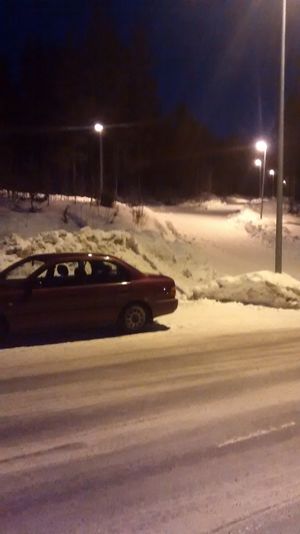
This Hashpoint was quite near the street. I had to walk 30 m to the Hashpoint through the snowy (60 cm) forest. I was at the hashpoint 8.00 p.m. Expedition started about at 7.30 p.m. This point situated only 3.2 km from my home.
Photos
Achievements
isopekka earned the Land geohash achievement
|
isopekka earned the Frozen Geohash Achievement
|
Isopekka earned the Last man standing achievement
|
Geohashing Expeditions and Plans on This Day
Expeditions and Plans
| 2017-03-20 | ||
|---|---|---|
| Rovaniemi, Finland | isopekka | In Rovaniemi, in Ounasrinne. |


