Difference between revisions of "2017-07-12 52 1"
From Geohashing
imported>Sourcerer m (→New expedition) |
imported>FippeBot m (Location) |
||
| Line 42: | Line 42: | ||
[[Category:Expeditions with photos]] | [[Category:Expeditions with photos]] | ||
[[Category:Coordinates reached]] | [[Category:Coordinates reached]] | ||
| + | {{location|GB|ENG|SFK}} | ||
Latest revision as of 02:43, 16 August 2019
| Wed 12 Jul 2017 in Norwich, UK: 52.4406650, 1.4743164 geohashing.info google osm bing/os kml crox |
Location
A field SE of Bungay, Suffolk, UK.
Participants
Plans
Expedition 1 of 2 spanning midnight 2017-07-12 52 1 - 2017-07-13 52 1 - ETA 23:15
Expedition
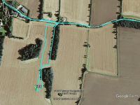
There was space to park beside a public footpath. The moon had just risen, glowing big and red near the horizon. There were wide tractor tracks through a ripe crop of fodder beans. The round trip walk was 1.3 km. The ground was damp and sticky and the temperature was 11C.
Photos
- Gallery
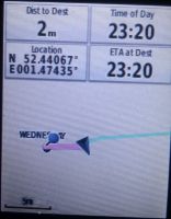
arrived @52.4407,1.4743
Achievements
Expeditions and Plans
| 2017-07-12 | ||
|---|---|---|
| Norwich, United Kingdom | Sourcerer | A field SE of Bungay, Suffolk, UK. |
Sourcerer's Expedition Links
2017-06-24 52 1 - 2017-07-12 52 1 - 2017-07-13 52 1 - KML file download of Sourcerer's expeditions for use with Google Earth.

