Difference between revisions of "2024-07-01 46 6"
From Geohashing
(Created page with "{{subst:Expedition}}") |
m (→Expedition) |
||
| (2 intermediate revisions by the same user not shown) | |||
| Line 1: | Line 1: | ||
| − | + | [[Image:{{{image|2024-07-01 46 6 04 4664.jpg}}}|thumb|left]] | |
| − | + | {{meetup graticule|date=2024-07-01|lat=46|lon=6}} | |
| − | [[Image:{{{image| | ||
| − | |||
| − | |||
| − | |||
| − | |||
| − | |||
| − | |||
== Location == | == Location == | ||
| − | + | Close to Chalet des Enfants, Bois de Benenté, Lausanne, Vaud, Switzerland | |
== Participants == | == Participants == | ||
| − | + | [[user:Crox|Crox]] | |
| − | |||
| − | == | + | == Expedition == |
| − | + | My holidays start today, and the location is in Lausanne (albeit outside of the city in the [https://fr.wikipedia.org/wiki/Jorat#Bois_du_Jorat Jorat] woods) - a perfect opportunity to resume geohashing after a long break (my last expedition was a [[2023-06-21 46 6|water hash]] more than a year ago). | |
| − | + | On the way there I paid a visit to the trees that we [https://www.lausanne.ch/vie-pratique/nature/patrimoine-arbore/un-arbre-un-enfant.html planted] for our kids a few years ago. | |
| − | |||
| − | + | Finding a way to get to the geohash location from Cugy proved to be difficult, a number of forest paths were closed due to logging work, but I eventually made it, and could ride my e-bike most of the way. | |
| − | |||
== Photos == | == Photos == | ||
| − | + | {{#vardefine:gaLines|3}} | |
| − | + | {{#vardefine:gaWidth|250}} | |
| − | -- | + | {{#vardefine:gaHeight|230}} |
| − | + | {{Gallery2| | |
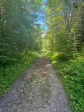
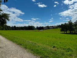
| − | + | {{GalleryItem | File:2024-07-01 46 6 01 4660.jpg | On the way... }} | |
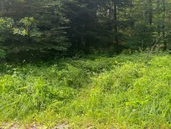
| + | {{GalleryItem | File:2024-07-01 46 6 02 4667.jpg | Nearly there... }} | ||
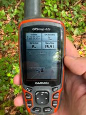
| + | {{GalleryItem | File:2024-07-01 46 6 03 4663.jpg | Reached! }} | ||
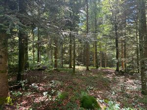
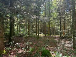
| + | {{GalleryItem | File:2024-07-01 46 6 04 4664.jpg | Today's location. }} | ||
| + | {{GalleryItem | File:2024-07-01 46 6 05 4669.jpg | Passing by [https://chaletdesenfants.ch/ Chalet des enfants] on the way back. }} | ||
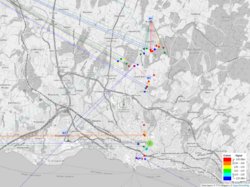
| + | {{GalleryItem | File:2024-07-01 46 6 06 ttn-mapper.png | I used the expedition as an opportunity to contribute to the [https://www.thethingsnetwork.org/community TTN] [https://ttnmapper.org/ coverage map]. }} | ||
| + | }} | ||
== Achievements == | == Achievements == | ||
| Line 36: | Line 32: | ||
__NOTOC__ | __NOTOC__ | ||
| − | |||
| − | |||
| − | |||
| − | |||
| − | |||
| − | |||
| − | |||
| − | |||
| − | |||
| − | |||
[[Category:Expeditions]] | [[Category:Expeditions]] | ||
| − | |||
[[Category:Expeditions with photos]] | [[Category:Expeditions with photos]] | ||
| − | |||
| − | |||
| − | |||
| − | |||
[[Category:Coordinates reached]] | [[Category:Coordinates reached]] | ||
| − | + | {{location|CH|VD}} | |
| − | |||
| − | |||
| − | |||
| − | |||
| − | |||
| − | |||
| − | |||
| − | |||
| − | |||
| − | |||
| − | |||
| − | |||
Latest revision as of 23:04, 3 July 2024
| Mon 1 Jul 2024 in 46,6: 46.5788974, 6.6654063 geohashing.info google osm bing/os kml crox |
Location
Close to Chalet des Enfants, Bois de Benenté, Lausanne, Vaud, Switzerland
Participants
Expedition
My holidays start today, and the location is in Lausanne (albeit outside of the city in the Jorat woods) - a perfect opportunity to resume geohashing after a long break (my last expedition was a water hash more than a year ago).
On the way there I paid a visit to the trees that we planted for our kids a few years ago.
Finding a way to get to the geohash location from Cugy proved to be difficult, a number of forest paths were closed due to logging work, but I eventually made it, and could ride my e-bike most of the way.
Photos
|
