Difference between revisions of "2024-11-28 -37 145"
Felix Dance (talk | contribs) ([retro picture]Pearl GPS proof) |
m |
||
| (2 intermediate revisions by 2 users not shown) | |||
| Line 7: | Line 7: | ||
Expedition 1: | Expedition 1: | ||
| − | * Pearl | + | *[[User:Pearl|Pearl]] |
Expedition 2: | Expedition 2: | ||
| Line 14: | Line 14: | ||
==Expedition 1 (Pearl)== | ==Expedition 1 (Pearl)== | ||
| − | + | After being alerted to an attainable hash in the morning, I checked it's location and saw it was in fact not far off the Darebin Creek trail. A very convenient fact as I had been intending to explore this trail to the north whenever I next got the chance. | |
| + | |||
| + | However I had a few errands to do this day, one being pick up some "Muc off" drivetrain cleaner, which appeared to only be in stock in Kew... | ||
| + | |||
| + | I accepted this due to needing to go via Alphington anyway so I took to Ride with GPS to map out a route for the first time that avoided any extra kms that may come from winging it. | ||
| + | |||
| + | I struggled with this route creation and accidentally added an additional 30ish km section that I didn't know how to delete. | ||
| + | |||
| + | I set off at about 3pm via Alphington and Kew, and after navigating (poorly) and taking wrong turns in the sun I was almost ready to bail on the geohash and go home. | ||
| + | |||
| + | Alas, I joined the Darebin Creek and set off just to see how far I would get. Turns out the trail and tailwind were wonderful and I had a lovely ride. | ||
| + | |||
| + | I made it to the hash at about 6:13pm, took a photo and quickly skedaddled as there were 3 parked cars with people in them watching. | ||
| + | |||
| + | The initial intention was to return via the Merri Creek however fortunately my Ride with GPS shortcomings meant I had added a alternate return (and outbound) route via Dalton Rd and St Georges Rd trail which I happily followed and shaved off about 8kms. | ||
| + | |||
| + | Many wrong turns were taken however ultimately a lovely route and I hope to do it returning via Merri Creek in the future. | ||
| + | |||
| + | <gallery heights="300px" mode="packed"> | ||
| + | Image:2024-11-28_-37_145_Felix Dance _1732845205418.jpg|Pearl at the hash | ||
| + | Image:2024-11-28_-37_145_Felix Dance _1732845210276.jpg|Pearl GPS proof | ||
| + | </gallery> | ||
==Expedition 2 (Stevage)== | ==Expedition 2 (Stevage)== | ||
Latest revision as of 14:14, 29 November 2024
| Thu 28 Nov 2024 in -37,145: -37.6199548, 145.0330538 geohashing.info google osm bing/os kml crox |
Location
In the middle of a street in Wollert, far northern suburbs of Melbourne.
Participants
Expedition 1:
Expedition 2:
Expedition 1 (Pearl)
After being alerted to an attainable hash in the morning, I checked it's location and saw it was in fact not far off the Darebin Creek trail. A very convenient fact as I had been intending to explore this trail to the north whenever I next got the chance.
However I had a few errands to do this day, one being pick up some "Muc off" drivetrain cleaner, which appeared to only be in stock in Kew...
I accepted this due to needing to go via Alphington anyway so I took to Ride with GPS to map out a route for the first time that avoided any extra kms that may come from winging it.
I struggled with this route creation and accidentally added an additional 30ish km section that I didn't know how to delete.
I set off at about 3pm via Alphington and Kew, and after navigating (poorly) and taking wrong turns in the sun I was almost ready to bail on the geohash and go home.
Alas, I joined the Darebin Creek and set off just to see how far I would get. Turns out the trail and tailwind were wonderful and I had a lovely ride.
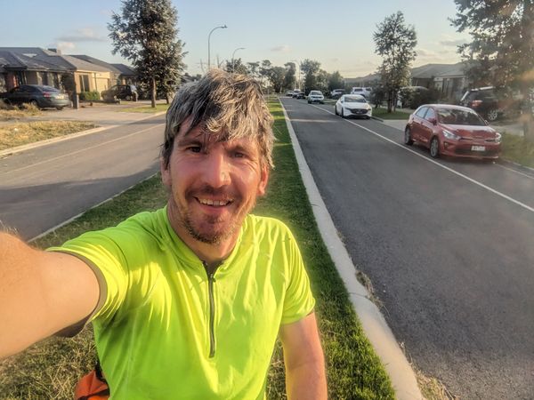
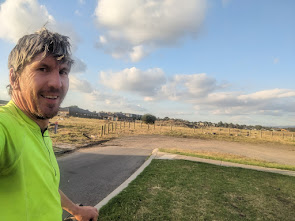
I made it to the hash at about 6:13pm, took a photo and quickly skedaddled as there were 3 parked cars with people in them watching.
The initial intention was to return via the Merri Creek however fortunately my Ride with GPS shortcomings meant I had added a alternate return (and outbound) route via Dalton Rd and St Georges Rd trail which I happily followed and shaved off about 8kms.
Many wrong turns were taken however ultimately a lovely route and I hope to do it returning via Merri Creek in the future.
Expedition 2 (Stevage)
I don't love geohashes in and around Epping. They start out well, with a nice ride up the Merri Creek Trail, and along the M80 trail, but before long you're forced onto some major roads with trucks and lots of traffic, and through depressing new suburbs: endless identical houses and the odd large vacant area earmarked for the next development. Oh, and the shopping centres which seem to trigger a feeling of consumerist existential despair deep inside of me.
But, it was a nice day and I needed the exercise.
In my usual way I faff about for much too long. My phone is low on battery, so I plug it in, but instead of doing the sensible thing of leaving it alone and getting ready, I fall into a vortex of targeted short-form videos, draining the battery further. Worse, I accidentally dislodge the cable, meaning at the end of an hour of "charging" I'm actually lower than I started, at 29%. Frustrated and annoyed at myself, I decide to just get going anyway. I'll have to forego a Strava recording. And maybe if I strap my solar panel to the front rack, I can eke out a few more percent.
It's after 5pm by the time I leave, and the sun is low enough that the solar panel is shaded by the bike if I'm heading east, and by trees when I'm heading north. Each time it gets shaded, the phone stops charging, vibrates, and switches on the screen. Soon I realise that it's costing me more battery than it's gaining, but I can't stop myself from trying.
The percent trickle down to 25% and I'm getting concerned. I definitively give up and unplug the panel. For 10 minutes until we hit a nice sunny open spot and I plug it in again. A few minutes later we're down to 23%. This time I really, truly definitively unplug.
Desperate to preserve the battery, since I might need to use my phone to take a train home or buy dinner, I try to do as much of the route by memory. Up the Merri Creek, right along the M80, over the bridge, and turning north onto Edgars Creek Trail. Eventually this runs out, and I need to start wangling through back streets to get over to the Darebin Creek Trail.
I allow myself a few glances at the map, and with minimal drama pick up the trail. I'm trying to work out what makes this suburb, Lalor, look different to my own. My street has a few mid-century cream brick houses, but here they absolutely dominate. The blocks are bigger. But eventually I realise it's the lack of gardens. For whatever reason, the people who live here are just not into gardening at all. Lots of lawns, a few scrappy yucca's or lemon trees, but that's about it.
I only have to cross one busy road, which isn't too dramatic. It's slowly dawning on me just how good today's route is. Almost entirely bike path, and just a few quiet streets.
The Darebin Creek Trail lives up to my recollection of being annoyingly hard to follow. Every now and then it hits a road, and never gives an indicatoin of which direction to go to find the trail on the other side. But it gets prettier and prettier as we proceed, finally opening up into a vast, peaceful grassland with patches of a particularly dramatic flax-like plant in full bloom that I can't identify. It's all really lovely, barely spoilt by transmission lines overhead.
There are a couple of horses wearing coats, at what looks like some kind of tiny animal farm for kids. I'd go over for a pat, but I'd probably have to muscle a few kids out of the way and that doesn't feel right.
I ride through Porsche Park and Maserati Park and try hard not to think about whey they're called that. Then I unceremoniously reach the very end of the Darebin Creek Trail. Have I ever been here before? I'm not sure.
Eventually I turn off the trail and after one more quiet street we're on Koobush Boulevard and homing in on the point. The point is in the median strip at the end of the street, right at the jarring edge of the development, which very much feels like the edge of civilisation. Behind me, a nicely developed street with houses and established landscaping and kids riding around on bikes. Ahead, a wasteland.
I now learn that Pearl has already been here, about an hour ago.
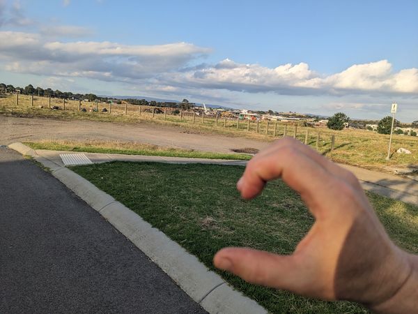
I attempt to create the other half of her hand-heart photo, but do a terrible job. Let's blame the stiffness I was feeling from the handlebars.
I'm still feeling good so I decide to just ride the whole way home instead of taking a train. It's a much smoother process, being able to follow landmarks that I remember from the way up.
Until I pass through a wormhole into the northern hemisphere, where for 10 minutes everyone seems to think they should be on the right-hand side of the trail. There's a guy jogging obstinately towards me until I eventually have to swerve. A couple of mums with prams and dogs, where I come to a complete stop, staring at them in bewilderment. And an elderly lady who confidently enters the trail walking on the wrong side, without even a glance. It's odd.
The biggest surprise is that I make it home without getting anything to eat. Perhaps the 4 pieces of buttered jam toast before I left wasn't such a bad idea after all.
Photos
Achievements
Stevage earned the Bicycle geohash achievement
|
Stevage earned the Two to the N achievement
|


