Difference between revisions of "2009-07-24 33 -84"
imported>NWoodruff m (→Gallery) |
imported>FippeBot m (Location) |
||
| (5 intermediate revisions by one other user not shown) | |||
| Line 19: | Line 19: | ||
=== [[User:NWoodruff|NWoodruff]] === | === [[User:NWoodruff|NWoodruff]] === | ||
| + | This was a nice ride though some back roads. I ended up having to find my own way with out the help of any map because Google didn't know about a bridge that had been out for what appears to be some time. | ||
| + | |||
| + | I parked at the end of the street. I met the home owner in his front yard. I explained Geohashing a bit and he seemed confused by it. I showed him on the map of where I was trying to get to and he said that it wasn't his property. He said that is property only extended back 100 feet. | ||
| + | |||
| + | I asked if he minded that I walk on his property to get to the point I was trying to access and he said that he didn't mind. | ||
| + | |||
| + | I found the hash point, took a few pictures and then made my way back to the street. The home owner was already gone at that time. I left him direction on how to find this web site and the google map print out of his property in his mail box. | ||
| + | |||
| + | I then made the trip back to Norcross. | ||
== Gallery == | == Gallery == | ||
| Line 25: | Line 34: | ||
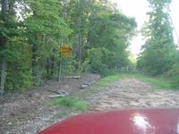
Image:2009072433-84NW01.JPG| This is what happens when you follow Google Maps directions. | Image:2009072433-84NW01.JPG| This is what happens when you follow Google Maps directions. | ||
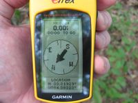
Image:2009072433-84NW02.JPG| 0.00 feet to go. The exact spot. | Image:2009072433-84NW02.JPG| 0.00 feet to go. The exact spot. | ||
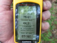
| − | Image:2009072433-84NW03.JPG| | + | Image:2009072433-84NW03.JPG| Time of the meetup. |
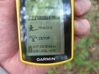
| − | Image:2009072433-84NW04.JPG| | + | Image:2009072433-84NW04.JPG| Date of the meetup. |
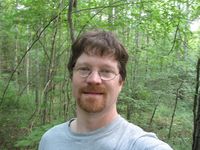
| − | Image:2009072433-84NW05.JPG| | + | Image:2009072433-84NW05.JPG| Standing on the exact spot with a Stupid Grin™ |
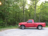
| + | Image:2009072433-84NW06.JPG| My truck at the end of the street. | ||
</gallery> | </gallery> | ||
| Line 37: | Line 47: | ||
[[Category:Coordinates reached]] | [[Category:Coordinates reached]] | ||
[[Category:Expeditions with photos]] | [[Category:Expeditions with photos]] | ||
| + | {{location|US|GA|SD}} | ||
Latest revision as of 04:44, 8 August 2019
| Fri 24 Jul 2009 in Atlanta: 33.3192913, -84.3832304 geohashing.info google osm bing/os kml crox |
Graticule
About
Expedition
NWoodruff
This was a nice ride though some back roads. I ended up having to find my own way with out the help of any map because Google didn't know about a bridge that had been out for what appears to be some time.
I parked at the end of the street. I met the home owner in his front yard. I explained Geohashing a bit and he seemed confused by it. I showed him on the map of where I was trying to get to and he said that it wasn't his property. He said that is property only extended back 100 feet.
I asked if he minded that I walk on his property to get to the point I was trying to access and he said that he didn't mind.
I found the hash point, took a few pictures and then made my way back to the street. The home owner was already gone at that time. I left him direction on how to find this web site and the google map print out of his property in his mail box.
I then made the trip back to Norcross.
Gallery
- Photo Gallery
Achievements
NWoodruff earned the Land geohash achievement
|
