Difference between revisions of "2009-12-13 34 -84"
imported>NWoodruff (→Achievements) |
m (Replacing http://wiki.xkcd.com/geohashing/Roswell%2C_Georgia with Roswell, Georgia) |
||
| (3 intermediate revisions by 2 users not shown) | |||
| Line 10: | Line 10: | ||
== Graticule == | == Graticule == | ||
| − | [ | + | [[Roswell, Georgia|Roswell]] |
== About == | == About == | ||
| Line 18: | Line 18: | ||
* [[User:NWoodruff|NWoodruff]] | * [[User:NWoodruff|NWoodruff]] | ||
| + | |||
| + | I had made it out to this Geohash spot as in it was only 10 miles from my house. There was no reason why I shouldn't make this meetup. | ||
| + | |||
| + | I drove out to the park and was kinda puzzled when I pulled into the park. 30 feet from the entrance way there is a big parking lot with a steel gate across the dirt road maybe 100 feet from the entrance way. There are signs posting the way to the walking trails. | ||
| + | |||
| + | I park and get out of my truck. I look at the eTrex and see that I am sill 0.35 of a mile from the hash point. The eTrex is pointing towards the steel gate across the dirt road. | ||
| + | |||
| + | The gate is open. I start walking down this dirt road thinking that they didn't want cars going down it. After about 300 feet of walking it comes to a rather steep hill going down. I can see car tracks where cars have struggled to get up and the large gravel rock the city had put down to help with traction. | ||
| + | |||
| + | I decided to walk back to my truck and drive. I'm glad that I did, as in there is another parking lot that is only 400 feet from the Geohash spot AND there are other cars parked there. | ||
| + | |||
| + | There are different trails here in the park. There is a concrete path for foot traffic and strollers and kid bikes. There are dirt paths for walking. There are dirt paths for hiking as it suggests that there are some steep hills to climb. And then there are some mountain bike trails for riding only and foot traffic is prohibited. | ||
| + | |||
| + | I decided to talk the walking trail as my eTrex is pointing that direction. As I was walking the 400 feet to the hash spot there were a few people that passed by me jogging the trail. | ||
| + | |||
| + | I was in luck the walking trail took me right to the spot, well that is with in 10 feet. Well within the 10 meters. I hopped down the small hill to find 2.49 feet to go. I settled on that and took a few pictures. | ||
| + | |||
| + | With the walking trail passing through the 10 meter requirement, there are probably 15 to 20 people today that could claim Coordinates Reached with out even knowing it. | ||
| + | |||
| + | I then walked back to the concrete walking paths and checked out the park for about 10 to 15 minutes. | ||
| + | |||
| + | I then got back in my truck and made my way back to Norcross. | ||
==Expeditions== | ==Expeditions== | ||
| Line 25: | Line 47: | ||
== Gallery == | == Gallery == | ||
<gallery caption="Photo Gallery" widths="200px" heights="200px" perrow="3"> | <gallery caption="Photo Gallery" widths="200px" heights="200px" perrow="3"> | ||
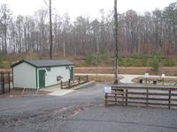
| − | Image:20091213_34_-84NW01.JPG| | + | Image:20091213_34_-84NW01.JPG| The park is open until the sun goes down. |
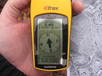
| + | Image:20091213_34_-84NW02.JPG| 2.49 feet to go. Close enough. | ||
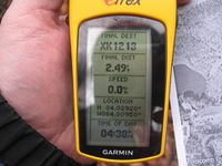
| + | Image:20091213_34_-84NW03.JPG| Time of the meetup. | ||
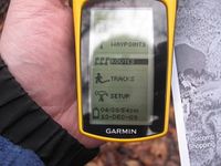
| + | Image:20091213_34_-84NW04.JPG| Date of the meetup. | ||
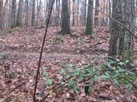
| + | Image:20091213_34_-84NW05.JPG| The actual hash spot was only about 10 feet from the walking trail. | ||
| + | Image:20091213_34_-84NW06.JPG| Me with a Stupid Grin™ and in need of a shave. | ||
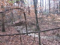
| + | Image:20091213_34_-84NW07.JPG| A picture of the stream standing on the Geohash spot. | ||
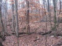
| + | Image:20091213_34_-84NW08.JPG| A picture of the opposite direction, still standing on the hash spot. | ||
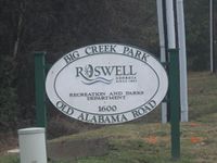
| + | Image:20091213_34_-84NW09.JPG| The park the Geohash spot was in. | ||
</gallery> | </gallery> | ||
| Line 38: | Line 68: | ||
[[Category:Coordinates reached]] | [[Category:Coordinates reached]] | ||
[[Category:Expeditions with photos]] | [[Category:Expeditions with photos]] | ||
| + | {{location|US|GA|FU}} | ||
Latest revision as of 12:26, 19 February 2020
| Sun 13 Dec 2009 in Roswell: 34.0292111, -84.3095068 geohashing.info google osm bing/os kml crox |
Graticule
About
10 feet off of a walking path in a city run park in Roswell Georgia.
People
I had made it out to this Geohash spot as in it was only 10 miles from my house. There was no reason why I shouldn't make this meetup.
I drove out to the park and was kinda puzzled when I pulled into the park. 30 feet from the entrance way there is a big parking lot with a steel gate across the dirt road maybe 100 feet from the entrance way. There are signs posting the way to the walking trails.
I park and get out of my truck. I look at the eTrex and see that I am sill 0.35 of a mile from the hash point. The eTrex is pointing towards the steel gate across the dirt road.
The gate is open. I start walking down this dirt road thinking that they didn't want cars going down it. After about 300 feet of walking it comes to a rather steep hill going down. I can see car tracks where cars have struggled to get up and the large gravel rock the city had put down to help with traction.
I decided to walk back to my truck and drive. I'm glad that I did, as in there is another parking lot that is only 400 feet from the Geohash spot AND there are other cars parked there.
There are different trails here in the park. There is a concrete path for foot traffic and strollers and kid bikes. There are dirt paths for walking. There are dirt paths for hiking as it suggests that there are some steep hills to climb. And then there are some mountain bike trails for riding only and foot traffic is prohibited.
I decided to talk the walking trail as my eTrex is pointing that direction. As I was walking the 400 feet to the hash spot there were a few people that passed by me jogging the trail.
I was in luck the walking trail took me right to the spot, well that is with in 10 feet. Well within the 10 meters. I hopped down the small hill to find 2.49 feet to go. I settled on that and took a few pictures.
With the walking trail passing through the 10 meter requirement, there are probably 15 to 20 people today that could claim Coordinates Reached with out even knowing it.
I then walked back to the concrete walking paths and checked out the park for about 10 to 15 minutes.
I then got back in my truck and made my way back to Norcross.
Expeditions
Gallery
- Photo Gallery
Achievements
NWoodruff earned the Land geohash achievement
|
NWoodruff earned the Consecutive geohash achievement
|
