Difference between revisions of "2010-06-20 52 -0"
imported>MagicIan m (→Photos) |
imported>FippeBot m (Location) |
||
| (2 intermediate revisions by one other user not shown) | |||
| Line 33: | Line 33: | ||
<gallery perrow="4"> | <gallery perrow="4"> | ||
| − | Image: | + | Image:200610_path.JPG|Photo of the track taken by Magician to the hashpoint for Sunday 20-06-2010, 52.667024° -0.19297° (Northampton, United Kingdom) |
| − | Image: | + | Image:200610_field.JPG|Photo of the entry point to the field taken by Magician to the hashpoint for Sunday 20-06-2010, 52.667024° -0.19297° (Northampton, United Kingdom) |
| + | Image:200610_sun.JPG|Photo taken at hashpoint for Sunday 20-06-2010, 52.667024° -0.19297° (Northampton, United Kingdom) | ||
| + | Image:200610_wheat.JPG|Photo taken at hashpoint for Sunday 20-06-2010, 52.667024° -0.19297° (Northampton, United Kingdom) | ||
| + | Image:200610_MagicIan2.JPG|Photo of [[User:MagicIan|MagicIan]] taken at hashpoint for Sunday 20-06-2010, 52.667024° -0.19297° (Northampton, United Kingdom) | ||
| + | Image:200610_Marker2.JPG|Photo of marker left near hashpoint for Sunday 20-06-2010, 52.667024° -0.19297° (Northampton, United Kingdom) | ||
| + | Image:200610_Flowers.JPG|Photo taken near hashpoint for Sunday 20-06-2010, 52.667024° -0.19297° (Northampton, United Kingdom) | ||
| + | Image:200610_Circle.JPG|Photo taken on way back from hashpoint for Sunday 20-06-2010, 52.667024° -0.19297° (Northampton, United Kingdom) | ||
| + | Image:200610_Trash2.JPG|Photo taken on way back from hashpoint for Sunday 20-06-2010, 52.667024° -0.19297° (Northampton, United Kingdom) | ||
</gallery> | </gallery> | ||
| Line 65: | Line 72: | ||
[[Category:Expeditions with photos]][[Category:Expeditions]][[Category:Coordinates reached]] | [[Category:Expeditions with photos]][[Category:Expeditions]][[Category:Coordinates reached]] | ||
| + | {{location|GB|ENG|LIN}} | ||
Latest revision as of 02:28, 9 August 2019
Location
In a field near Crowland
| Sun 20 Jun 2010 in Northampton: 52.6670247, -0.1929691 geohashing.info google osm bing/os kml crox |
Participants
Expedition
This was the second of MagicIan's 4-in-a-row geohashes on this day... He parked up on Low Road and walked in a circuit down Mill Drove until he found a place to enter the field where he could reach the hashpoint without damaging any crops in the field. On the way back, he left a marker to show any future geohashers where to go before completing the circuit. When he got back to his car, there was a police dog van parked next to it. As he approached, he was getting worried that someone might've thought he was trespassing, but the van was empty and so he drove away quickly before the police came back and asked any questions! Again, he picked up some rubbish on the way back to the car, which qualified him for a Geotrash ribbon.
Achievements
MagicIan earned the GeoTrash Geohash Achievement
|
Photos
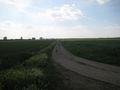
Photo of the track taken by Magician to the hashpoint for Sunday 20-06-2010, 52.667024° -0.19297° (Northampton, United Kingdom)
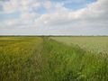
Photo of the entry point to the field taken by Magician to the hashpoint for Sunday 20-06-2010, 52.667024° -0.19297° (Northampton, United Kingdom)
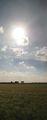
Photo taken at hashpoint for Sunday 20-06-2010, 52.667024° -0.19297° (Northampton, United Kingdom)
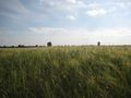
Photo taken at hashpoint for Sunday 20-06-2010, 52.667024° -0.19297° (Northampton, United Kingdom)
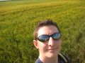
Photo of MagicIan taken at hashpoint for Sunday 20-06-2010, 52.667024° -0.19297° (Northampton, United Kingdom)
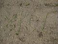
Photo of marker left near hashpoint for Sunday 20-06-2010, 52.667024° -0.19297° (Northampton, United Kingdom)
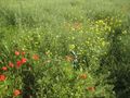
Photo taken near hashpoint for Sunday 20-06-2010, 52.667024° -0.19297° (Northampton, United Kingdom)
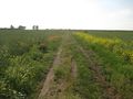
Photo taken on way back from hashpoint for Sunday 20-06-2010, 52.667024° -0.19297° (Northampton, United Kingdom)
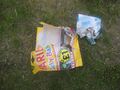
Photo taken on way back from hashpoint for Sunday 20-06-2010, 52.667024° -0.19297° (Northampton, United Kingdom)


