Difference between revisions of "2010-08-18 45 -73"
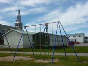
imported>Sara (This was also the only time I have ever seen a playground with x-rated grafiti drawings (not pictured here).) |
m (More specific location) |
||
| (One intermediate revision by one other user not shown) | |||
| Line 42: | Line 42: | ||
[[Category:Coordinates not reached]] | [[Category:Coordinates not reached]] | ||
[[Category:Not reached - No public access]] | [[Category:Not reached - No public access]] | ||
| + | {{location|CA|QC|16}} | ||
Latest revision as of 23:31, 9 August 2020
| Wed 18 Aug 2010 in 45,-73: 45.2993652, -73.6767274 geohashing.info google osm bing/os kml crox |
Location
In a field (of fava beans?) very near the school in Saint-Isidore, Québec.
Participants
Sara, her husband, and her son and daughter.
Planning
This was the first full day of our family vacation. We had left home the previous evening, and with kids sleeping in the back seat we had driven to Plattsburgh, NY, about an hour south of Montreal. In the morning, our ipad found a signal just south of the US/Canada border, and we were pleased to discover a conveniently-located hashpoint that appeared from Google satellite view to be accessible by children.
Expedition
I didn't mention anything about geohashing to the border agent. I just said we were headed to Montreal to start our vacation.
We parked at the school in Saint-Isidore. I have never before seen a school with a corn field extending right up to the building.
This was a fun way to begin our vacation, and it turned out that our next convenient geohashing opportunity was on the way home from our vacation.


