Difference between revisions of "2011-09-16 49 -123"
imported>Relet (→Location) |
m (More specific location) |
||
| (2 intermediate revisions by 2 users not shown) | |||
| Line 31: | Line 31: | ||
== Images == | == Images == | ||
You'd better believe there'll be pictures! Awesome pictures! | You'd better believe there'll be pictures! Awesome pictures! | ||
| + | |||
| + | [[File:2011-09-16_49_-123_IMGP5097.JPG|thumb|400px]] | ||
[[Category:Expeditions]] | [[Category:Expeditions]] | ||
[[Category:Expeditions with photos]] | [[Category:Expeditions with photos]] | ||
[[Category: Coordinates reached]] | [[Category: Coordinates reached]] | ||
| + | {{location|CA|BC|MV}} | ||
Latest revision as of 23:46, 9 August 2020
| Fri 16 Sep 2011 in 49,-123: 49.2130838, -123.2013075 geohashing.info google osm bing/os kml crox |
Participants
Location
On a beach on Iona Island in Richmond!
Today's battleship location is: H 3
Expedition
17:00 meetup?
Geohash should be accessible by Hashmobile as well as by bike!
High tide isn't until 20:00+ so boots probably wont be required.
The bike ride to the end of the Iona Island Jetty is also a fun post-hash activity!
Robyn
I'm training for a triathlon and today's workout called for 60 minutes of biking immediately followed by ten minutes of running, so I planned to leave at ten to four and complete the workout right on time at the geohash. That didn't happen. I reached the general vicinity of the geohash at ten to five with ten minutes left in the bike portion of the workout, so I went past, then turned around and came back to burn the last few minutes, confusing the arriving geohashers. "I'm coming back!" I said. Then when I turned around and saw them stopped added "Don't wait for me!" several times, until I had zipped past them. Then I parked the bike, ran my ten minutes and finally joined in the geohashing adventure.
Images
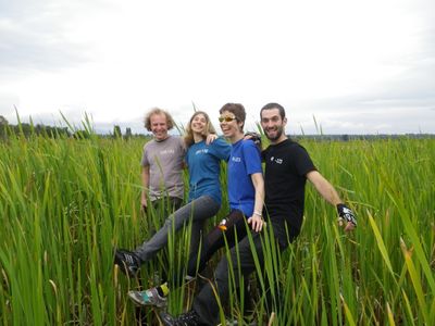
You'd better believe there'll be pictures! Awesome pictures!
