Difference between revisions of "2012-01-22 35 -82"
From Geohashing
imported>Jiml (Expand Template) |
imported>FippeBot m (Location) |
||
| (2 intermediate revisions by one other user not shown) | |||
| Line 1: | Line 1: | ||
| − | |||
| − | |||
| − | |||
| − | |||
<!-- If you did not specify these parameters in the template, please substitute appropriate values for IMAGE, LAT, LON, and DATE (YYYY-MM-DD format) | <!-- If you did not specify these parameters in the template, please substitute appropriate values for IMAGE, LAT, LON, and DATE (YYYY-MM-DD format) | ||
| Line 18: | Line 14: | ||
}} | }} | ||
| − | + | ||
__NOTOC__ | __NOTOC__ | ||
== Location == | == Location == | ||
| − | + | Hot Springs, NC, near the Tennessee border | |
== Participants == | == Participants == | ||
| − | + | ||
| + | * [[User:Greenweaver]] | ||
== Plans == | == Plans == | ||
<!-- what were the original plans --> | <!-- what were the original plans --> | ||
| + | |||
| + | Unknown | ||
== Expedition == | == Expedition == | ||
<!-- how it all turned out. your narrative goes here. --> | <!-- how it all turned out. your narrative goes here. --> | ||
| + | |||
| + | Made it to geohash in inactive Asheville graticule today. There is a learning curve for editing this wiki. | ||
== Tracklog == | == Tracklog == | ||
| Line 39: | Line 40: | ||
Image:2010-##-## ## ## Alpha.jpg | Witty Comment | Image:2010-##-## ## ## Alpha.jpg | Witty Comment | ||
--> | --> | ||
| + | |||
<gallery perrow="5"> | <gallery perrow="5"> | ||
| + | |||
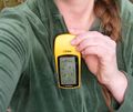
| + | Image:2012-01-22 35 -82 greenweaver.jpg | A GPS | ||
| + | |||
</gallery> | </gallery> | ||
| Line 46: | Line 51: | ||
<!-- Add any achievement ribbons you earned below, or remove this section --> | <!-- Add any achievement ribbons you earned below, or remove this section --> | ||
| + | * Land Geohash | ||
| − | |||
| − | |||
| − | |||
| − | |||
| − | |||
| − | |||
| − | |||
| − | |||
[[Category:Expeditions]] | [[Category:Expeditions]] | ||
| − | |||
[[Category:Expeditions with photos]] | [[Category:Expeditions with photos]] | ||
| − | |||
| − | |||
| − | |||
| − | |||
| − | |||
[[Category:Coordinates reached]] | [[Category:Coordinates reached]] | ||
| − | + | {{location|US|NC|MD}} | |
| − | |||
| − | |||
| − | |||
| − | |||
| − | |||
| − | |||
| − | |||
| − | |||
| − | |||
Latest revision as of 04:27, 6 August 2019
| Sun 22 Jan 2012 in 35,-82: 35.9301409, -82.8660644 geohashing.info google osm bing/os kml crox |
Location
Hot Springs, NC, near the Tennessee border
Participants
Plans
Unknown
Expedition
Made it to geohash in inactive Asheville graticule today. There is a learning curve for editing this wiki.
Tracklog
Photos
Achievements
- Land Geohash
