Difference between revisions of "2014-09-06 48 16"
imported>Patrizius (An expedition message sent via Geohash Droid for Android.) |
imported>FippeBot m (Location) |
||
| (8 intermediate revisions by 3 users not shown) | |||
| Line 1: | Line 1: | ||
| − | |||
| − | |||
| − | |||
| − | |||
| − | |||
| − | |||
| − | |||
| − | |||
| − | |||
| − | |||
{{meetup graticule | {{meetup graticule | ||
| lat=48 | | lat=48 | ||
| Line 15: | Line 5: | ||
}} | }} | ||
| − | |||
__NOTOC__ | __NOTOC__ | ||
== Location == | == Location == | ||
| − | + | [[Image:IMG 20140906 thewindhurts.jpg | thumb | left | Surprise! another cornfield.]] This time around the hash fell into a cornfield between Mistelbach and Poysdorf, north of Vienna.. Luckily nearby access roads provided easy accessibility. | |
| + | |||
== Participants == | == Participants == | ||
| − | + | ||
| − | + | * [[User:Patrizius|Patrizius]] | |
| + | * [[User:B2c|B2c]] | ||
== Plans == | == Plans == | ||
| − | + | After a short survey of today's hash opportunities they quickly settled for the Poysdorf hash about 50km north of Vienna. All other hashes where either too far away or too hard to get to. | |
== Expedition == | == Expedition == | ||
| − | + | As it was the weekend the hashers took their good time and started in the late afternoon. | |
| + | |||
| + | They met at the hashcave, boarded the hashmobile and travelled northward. They already knew that the hash was in | ||
| + | a cornfield (again!), but the access roads looked more like dirt tracks, so in the worst case they would have to | ||
| + | cover the last ~800m by foot. | ||
| + | |||
| + | After crossing a small village and passing by a soccer match, they reached the vicinity of the hashpoint. | ||
| + | Although one access road turned out to be little more than a trail, the other one was perfectly usable. | ||
| + | They parked the car next to a maintenance access of a wind turbine and changed into their hash gear | ||
| + | (hello alpine boots!). | ||
| + | |||
| + | From there on they continued by foot along a little trail next to the corn | ||
| + | field until the hash was only a couple meters away. They turned into the cornfield and hashed in | ||
| + | another one. | ||
== Tracklog == | == Tracklog == | ||
| − | + | [[File:Gps-2014-09-06-wien.png]] | |
== Photos == | == Photos == | ||
| − | < | + | <gallery caption="Photo Gallery" widths="320px" heights="213px" perrow="3"> |
| − | Image: | + | Image:IMG 20140906 thewindhurts.jpg | Those turbines start creeping me out. |
| − | -- | + | Image:IMG 20140906 thewindhurts2.jpg | Even more of those suckers. |
| − | + | Image:IMG 20140906 174622.jpg | Turbinehead. | |
| + | Image:IMG 20140906 turbine grin.jpg | Turbineheads. | ||
| + | Image:IMG 20140906 hashmobile2.jpg | Prepping for the hash. | ||
| + | Image:IMG 20140906 tothehash.jpg | Approaching the hash. | ||
| + | Image:IMG 20140906 grin.jpg | Stupid grin(tm). | ||
| + | Image:Gps 2014-09-06-17-54-03.png | Proof. | ||
| + | Image:Hashdroid 2014-09-06-17-54-29.png | More proof. | ||
</gallery> | </gallery> | ||
| + | |||
== Achievements == | == Achievements == | ||
| − | {{ | + | {{consecutive geohash 2 |
| − | + | | count = 4 | |
| + | | latitude = 47 | ||
| + | | longitude = 14 | ||
| + | | date = 2014-09-03 | ||
| + | | name = B2c | ||
| + | }} | ||
| + | {{consecutive geohash 2 | ||
| + | | count = 4 | ||
| + | | latitude = 47 | ||
| + | | longitude = 14 | ||
| + | | date = 2014-09-03 | ||
| + | | name = Patrizius | ||
| + | }} | ||
| − | |||
| − | |||
| − | |||
| − | |||
| − | |||
| − | |||
| − | |||
| − | |||
| − | |||
| − | |||
| − | |||
| − | |||
[[Category:Expeditions]] | [[Category:Expeditions]] | ||
| − | |||
[[Category:Expeditions with photos]] | [[Category:Expeditions with photos]] | ||
| − | |||
| − | |||
| − | |||
| − | |||
| − | |||
[[Category:Coordinates reached]] | [[Category:Coordinates reached]] | ||
| − | + | {{location|AT|NÖ|MI}} | |
| − | |||
| − | |||
| − | |||
| − | |||
| − | |||
| − | |||
| − | |||
| − | |||
| − | |||
| − | |||
| − | |||
| − | |||
| − | |||
| − | |||
| − | |||
| − | |||
| − | |||
Latest revision as of 01:17, 15 August 2019
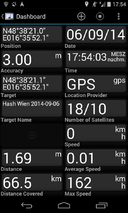
| Sat 6 Sep 2014 in 48,16: 48.6391881, 16.5978058 geohashing.info google osm bing/os kml crox |
Location
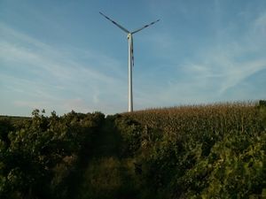
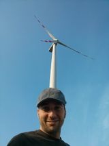
This time around the hash fell into a cornfield between Mistelbach and Poysdorf, north of Vienna.. Luckily nearby access roads provided easy accessibility.
Participants
Plans
After a short survey of today's hash opportunities they quickly settled for the Poysdorf hash about 50km north of Vienna. All other hashes where either too far away or too hard to get to.
Expedition
As it was the weekend the hashers took their good time and started in the late afternoon.
They met at the hashcave, boarded the hashmobile and travelled northward. They already knew that the hash was in a cornfield (again!), but the access roads looked more like dirt tracks, so in the worst case they would have to cover the last ~800m by foot.
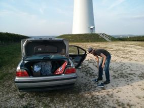
After crossing a small village and passing by a soccer match, they reached the vicinity of the hashpoint. Although one access road turned out to be little more than a trail, the other one was perfectly usable. They parked the car next to a maintenance access of a wind turbine and changed into their hash gear (hello alpine boots!).
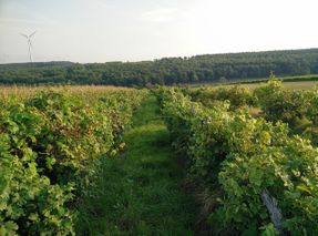
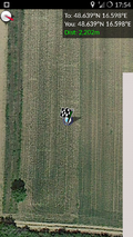
From there on they continued by foot along a little trail next to the corn field until the hash was only a couple meters away. They turned into the cornfield and hashed in another one.
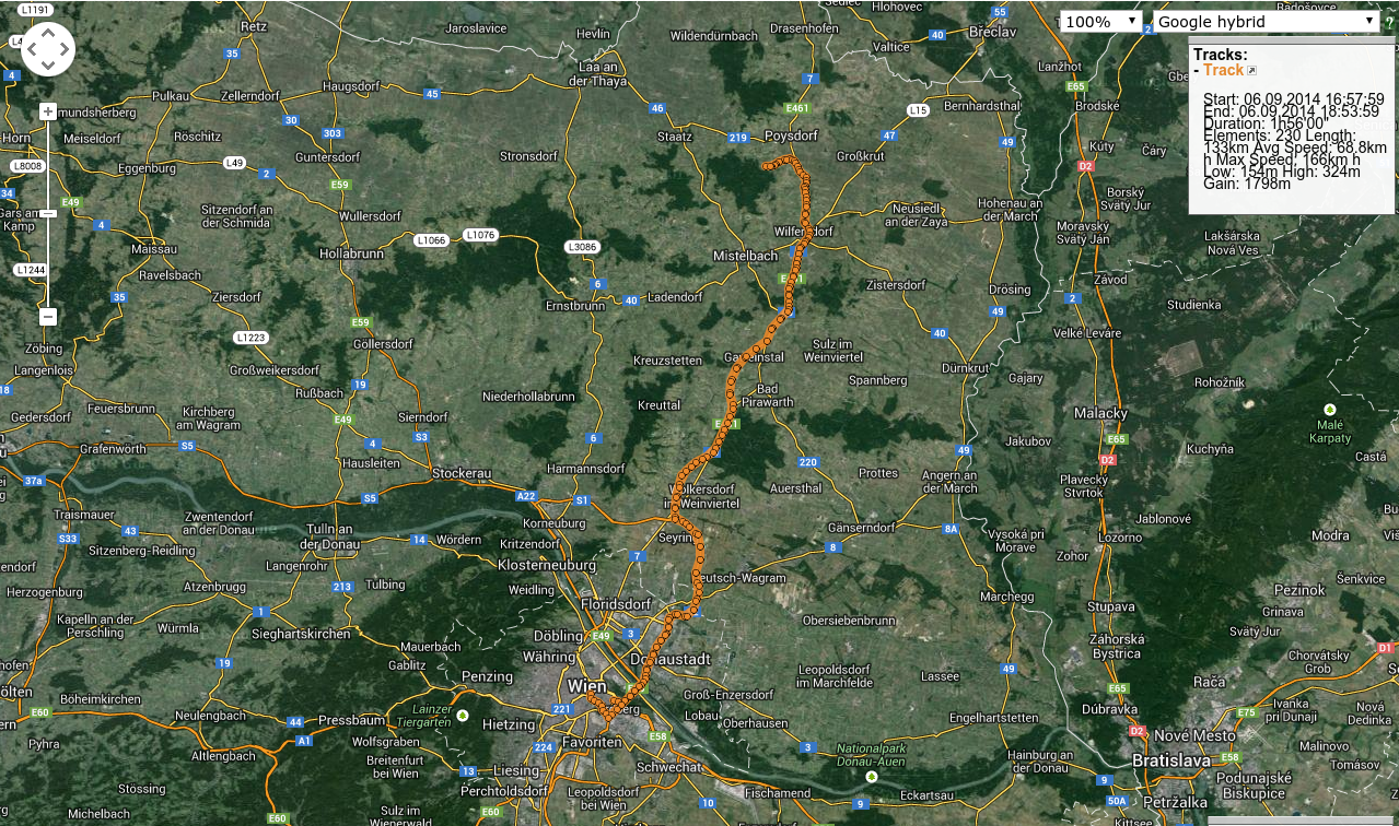
Tracklog
Photos
- Photo Gallery
Achievements
B2c earned the Consecutive geohash achievement
|
Patrizius earned the Consecutive geohash achievement
|
