Difference between revisions of "2008-06-08 42 -71"
imported>Ben |
m (fix, sorry) |
||
| (8 intermediate revisions by 4 users not shown) | |||
| Line 8: | Line 8: | ||
==The Location== | ==The Location== | ||
| − | + | {{egl|2008-06-08|42|-72|text=Map Coordinates}} | |
The site is in the woods in Foxborough, but less than a mile from the center of Mansfield. It is best accessible either from a (plant) nursery or from nearby railroad tracks. It's unclear who owns the property; there are no obvious boundaries (although the land is not the most passable in places). | The site is in the woods in Foxborough, but less than a mile from the center of Mansfield. It is best accessible either from a (plant) nursery or from nearby railroad tracks. It's unclear who owns the property; there are no obvious boundaries (although the land is not the most passable in places). | ||
| Line 16: | Line 16: | ||
We approached from Mansfield center, walking up County Street. It turned out that, for whatever reason, there was a substantial network of trails in the relevent segment of forest, such that we didn't have any trouble getting quite near the point. The trails connect both to the railroad tracks to the east, and the nursery to the southwest. | We approached from Mansfield center, walking up County Street. It turned out that, for whatever reason, there was a substantial network of trails in the relevent segment of forest, such that we didn't have any trouble getting quite near the point. The trails connect both to the railroad tracks to the east, and the nursery to the southwest. | ||
| − | <gallery caption="A Walk in the Woods" widths="200px" heights="200px" perrow=" | + | <gallery caption="A Walk in the Woods" widths="200px" heights="200px" perrow="2"> |
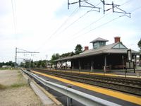
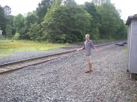
Image: 2008-06-08-42-71-01.jpg|The Mansfield train station. [[User:Ben|Ben]] made it to the hash from Providence using only mass transit. | Image: 2008-06-08-42-71-01.jpg|The Mansfield train station. [[User:Ben|Ben]] made it to the hash from Providence using only mass transit. | ||
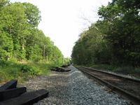
Image: 2008-06-08-42-71-06.jpg|The train tracks are fenced off for a while, but north of County St., it's easy enough to walk along them. | Image: 2008-06-08-42-71-06.jpg|The train tracks are fenced off for a while, but north of County St., it's easy enough to walk along them. | ||
| − | Image: 2008-06-08-42-71-07.jpg|Next to the tracks, there was a tire. | + | </gallery> |
| + | <gallery caption="A Walk in the Woods" widths="200px" heights="200px" perrow="3">Image: 2008-06-08-42-71-07.jpg|Next to the tracks, there was a tire. | ||
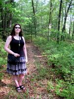
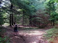
Image: 2008-06-08-42-71-02.jpg|Grace at the point. | Image: 2008-06-08-42-71-02.jpg|Grace at the point. | ||
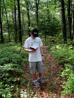
Image: 2008-06-08-42-71-03.jpg|Ben at the point. It was quite hot, humid, and bug-filled, so we didn't stay long. | Image: 2008-06-08-42-71-03.jpg|Ben at the point. It was quite hot, humid, and bug-filled, so we didn't stay long. | ||
| Line 26: | Line 27: | ||
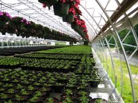
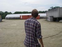
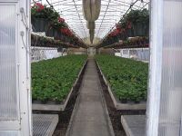
Image: 2008-06-08-42-71-08.jpg|The nursery. No one was around (it being a Sunday), but there was plenty of non-native fauna. | Image: 2008-06-08-42-71-08.jpg|The nursery. No one was around (it being a Sunday), but there was plenty of non-native fauna. | ||
</gallery> | </gallery> | ||
| + | |||
| + | |||
| + | ==A Separate Expedition== | ||
| + | |||
| + | [[User:Aetius|James]] and Sam also reached this geohash, albeit by a slightly more difficult route. They parked across from the plant nursery on Spring St and, mindful of a "no trespassing" sign, decided to travel parallel to the railroad tracks. On their journey, they discovered an abandoned fold-out couch and the body of a quite large but unfortunately deceased turtle. Upon reaching an appropriate spot, they bushwhacked until they came across the sign left by Ben and Grace as well as, to their relief, a trail back out through the nursery. | ||
| + | |||
| + | |||
| + | <gallery caption="Exploring by the Railroad Tracks" widths="200px" heights="200px" perrow="3"> | ||
| + | Image: Sam and Tracks-wr.JPG|Sam basking in the glory of adventure. | ||
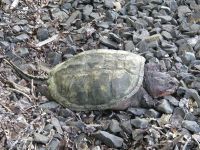
| + | Image: Turtle-wr.JPG|The turtle they encountered by the railroad tracks. RIP | ||
| + | Image: Couch-wr.JPG|Abandoned couch by the railroad tracks. Note the broken bottles scattered in the dirt. | ||
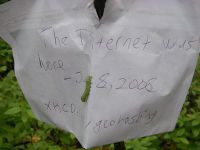
| + | Image: Sign-wr.JPG|They find Ben and Grace's sign. The inchworm seems to be happy to meet the internet. | ||
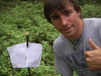
| + | Image: James and Sign-wr.JPG|So does [[User:Aetius|James]]. | ||
| + | Image: Empty_Plant_Nursery-wr.JPG|Sam sneaking through the nursery, abandoned for the day. | ||
| + | Image: Flower Nursery-wr.JPG|This area smelled suspiciously like a banana smoothie. | ||
| + | </gallery> | ||
| + | |||
| + | [[Category:Expeditions]] | ||
| + | [[Category:Expeditions with photos]] | ||
| + | [[Category:Coordinates reached]] | ||
| + | {{location|US|MA|NO}} | ||
Latest revision as of 18:50, 18 January 2022
| Sun 8 Jun 2008 in 42,-71: 42.0475817, -71.2309159 geohashing.info google osm bing/os kml crox |
The Location
The site is in the woods in Foxborough, but less than a mile from the center of Mansfield. It is best accessible either from a (plant) nursery or from nearby railroad tracks. It's unclear who owns the property; there are no obvious boundaries (although the land is not the most passable in places).
The Geohash
We approached from Mansfield center, walking up County Street. It turned out that, for whatever reason, there was a substantial network of trails in the relevent segment of forest, such that we didn't have any trouble getting quite near the point. The trails connect both to the railroad tracks to the east, and the nursery to the southwest.
- A Walk in the Woods
The Mansfield train station. Ben made it to the hash from Providence using only mass transit.
- A Walk in the Woods
A Separate Expedition
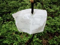
James and Sam also reached this geohash, albeit by a slightly more difficult route. They parked across from the plant nursery on Spring St and, mindful of a "no trespassing" sign, decided to travel parallel to the railroad tracks. On their journey, they discovered an abandoned fold-out couch and the body of a quite large but unfortunately deceased turtle. Upon reaching an appropriate spot, they bushwhacked until they came across the sign left by Ben and Grace as well as, to their relief, a trail back out through the nursery.
- Exploring by the Railroad Tracks
So does James.
