Difference between revisions of "2020-01-22 53 10"
m (clearing up username confusion) |
(→Photos: photos 38) |
||
| Line 12: | Line 12: | ||
==Photos== | ==Photos== | ||
| − | + | <gallery> | |
| − | + | File:2020-01-22 53 10 7.png | proof 1 | |
| + | File:2020-01-22 53 10 8.png | proof 2 | ||
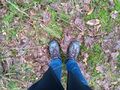
| + | File:2020-01-22 53 10 1.jpg | the hash | ||
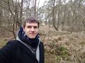
| + | File:2020-01-22 53 10 2.jpg | π π π | ||
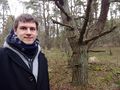
| + | File:2020-01-22 53 10 3.jpg | facing the other way | ||
| + | File:2020-01-22 53 10 4.jpg | pano 1 | ||
| + | File:2020-01-22 53 10 5.jpg | pano 2 | ||
| + | File:2020-01-22 53 10 6.jpg | at a nearby clearing | ||
</gallery> | </gallery> | ||
Latest revision as of 16:28, 16 January 2022
| Wed 22 Jan 2020 in 53,10: 53.7142621, 10.0481669 geohashing.info google osm bing/os kml crox |
Location
in a forest near a heath-like open space in Norderstedt-Glashütte, Schleswig-Holstein
Participants
Expedition
π π π (log from April 2020)
Instead of taking the busy streets, I cycled a calmer but slightly longer route for 13 km from my home. When I finally arrived at the hash, I was soaked in sweat because I had planned for much lower temperatures. I parked my bike on the forest path and walked the last 100 m to the hashpoint, enjoying the complete quietness of the forest (there was no street for 750 m around). I took a while to find the location, and after documenting I went to a beautiful heath-like open space another 100 m from the path. Except for a hunters' lookout, there was nothing human-made in sight. I went back to my bike and cycled a different route home, making this my longest geohashing bike tour since my first expedition.
Photos
proof 1

proof 2
the hash
π π π
facing the other way
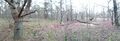
pano 1
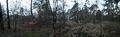
pano 2
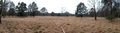
at a nearby clearing


Achievements
Land geohash, Bicycle geohash, Dark Ages