Difference between revisions of "2009-12-21 37 -121"
From Geohashing
imported>Anthony (fill in) |
imported>Anthony (→Photos: replace incorrect image with correct ones) |
||
| Line 28: | Line 28: | ||
== Photos == | == Photos == | ||
| − | + | <gallery> | |
| − | + | Image:GeohashGPS2009-12-21.jpg | |
| − | < | + | Image:GeohashGPS2009-12-21b.jpg |
| − | + | Image:GeohashLocation2009-12-21.jpg | |
| − | + | Image:GeohashLocation2009-12-21b.jpg | |
| − | + | </gallery> | |
| − | |||
| − | |||
| − | -- | ||
| − | |||
| − | |||
| − | |||
| − | |||
| − | |||
| − | |||
| − | |||
| − | -- | ||
| − | |||
| − | < | ||
| − | |||
| − | |||
| − | |||
| − | |||
| − | |||
| − | |||
| − | |||
| − | |||
| − | |||
| − | |||
| − | |||
[[Category:Expeditions]][[Category:Coordinates reached]] | [[Category:Expeditions]][[Category:Coordinates reached]] | ||
Revision as of 00:52, 3 January 2010
| Mon 21 Dec 2009 in 37,-121: 37.6955207, -121.7839821 geohashing.info google osm bing/os kml crox |
Location
Portola Avenue and Murrieta Boulevard in Livermore. According to GE, the point was slightly off the crosswalk in the intersection.
Participants
Expedition
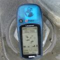
I went to this spot on my lunch break, because it's about 1.5km from work (though it's closer to 3km on the fast, non-residential streets). I parked in the little shopping center north of the intersection, then walked across the crosswalk to get close to the point. I couldn't get a photo of the GPS at the hashpoint, so I tried to get one at each end of the crosswalk. Only one of those came out readable, though.


