Difference between revisions of "2010-07-22 44 -69"
From Geohashing
imported>UncleOp (→Location) |
imported>UncleOp (→Photos) |
||
| Line 33: | Line 33: | ||
== Photos == | == Photos == | ||
| − | <!-- Insert pictures between the gallery tags using the following format: | + | <!-- Insert pictures between the gallery tags using the following format: --> |
| − | + | ||
| − | + | <gallery perrow="3"> | |
| − | <gallery perrow=" | + | Image:2010_07_22_44_-69_1.jpg | [[User:UncleOp|Del]] with house in background |
| + | Image:2010_07_22_44_-69_2.jpg | Boring picture of location | ||
| + | Image:2010_07_22_44_-69_3.jpg | Another boring picture | ||
</gallery> | </gallery> | ||
Revision as of 03:55, 23 July 2010
| Thu 22 Jul 2010 in 44,-69: 44.2875466, -69.3982983 geohashing.info google osm bing/os kml crox |
Location
Just off the road, to the south of a residence. Farther east, but not visible, is a lake.
Participants
Del, who added a bunch of the Maine graticules way back when and finally got around to doing a run.
Plans
Expedition
Tracklog
Photos
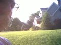
Del with house in background
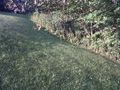
Boring picture of location
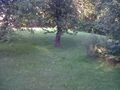
Another boring picture


Achievements