Difference between revisions of "2012-02-29 41 -73"
From Geohashing
imported>Jiml m (Add results) |
imported>Jiml m (Adjust result codes) |
||
| Line 32: | Line 32: | ||
*at the hash point or very close -- [[User:NCommander|NCommander]] [http://www.openstreetmap.org/?lat=41.31293599&lon=-73.17940274&zoom=16&layers=B000FTF @41.3129,-73.1794] 17:47, 29 February 2012 (EST) | *at the hash point or very close -- [[User:NCommander|NCommander]] [http://www.openstreetmap.org/?lat=41.31293599&lon=-73.17940274&zoom=16&layers=B000FTF @41.3129,-73.1794] 17:47, 29 February 2012 (EST) | ||
| − | |||
| − | |||
== Photos == | == Photos == | ||
| − | + | ||
| − | |||
| − | |||
<gallery perrow="5"> | <gallery perrow="5"> | ||
| Line 51: | Line 47: | ||
{{#vardefine:ribbonwidth|800px}} | {{#vardefine:ribbonwidth|800px}} | ||
<!-- Add any achievement ribbons you earned below, or remove this section --> | <!-- Add any achievement ribbons you earned below, or remove this section --> | ||
| + | |||
| + | * Land Geohash | ||
| + | * Leap Day | ||
| − | |||
| − | |||
| − | |||
| − | |||
| − | |||
| − | |||
| − | |||
[[Category:Expeditions]] | [[Category:Expeditions]] | ||
| Line 66: | Line 58: | ||
| − | + | ||
[[Category:Expeditions]] | [[Category:Expeditions]] | ||
| − | + | ||
[[Category:Expeditions with photos]] | [[Category:Expeditions with photos]] | ||
| − | |||
| − | |||
| − | |||
| − | |||
| − | |||
[[Category:Coordinates reached]] | [[Category:Coordinates reached]] | ||
| − | |||
| − | |||
| − | |||
| − | |||
| − | |||
| − | |||
| − | |||
| − | |||
| − | |||
| − | |||
Revision as of 01:42, 28 June 2012
| Wed 29 Feb 2012 in 41,-73: 41.3129303, -73.1794689 geohashing.info google osm bing/os kml crox |
Location
North of Bridgeport
Participants
Plans
Expedition
- at the hash point or very close -- NCommander @41.3129,-73.1794 17:47, 29 February 2012 (EST)
Photos
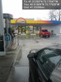
fueling @40.9181,-73.7751
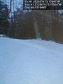
Hash point from the road. Approx 5 to 10 feet @41.3129,-73.1793
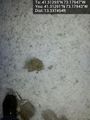
ground zero @41.3129,-73.1794


Achievements
- Land Geohash
- Leap Day