Difference between revisions of "2008-05-31 41 -77"
(→The State Park) |
|||
| Line 10: | Line 10: | ||
[http://maps.google.com/maps?f=q&hl=en&geocode=&q=41.0374870832648067,+-77.2812664767643918&ie=UTF8&ll=41.037621,-77.28097&spn=0.000991,0.0025&t=h&z=19&iwloc=addr Google maps] shows that it is in the corner of a farmer field right next to the road. | [http://maps.google.com/maps?f=q&hl=en&geocode=&q=41.0374870832648067,+-77.2812664767643918&ie=UTF8&ll=41.037621,-77.28097&spn=0.000991,0.0025&t=h&z=19&iwloc=addr Google maps] shows that it is in the corner of a farmer field right next to the road. | ||
| − | This location is in the [[Williamsport, Pennsylvania|Williamsport, PA]] | + | This location is in the [[Williamsport, Pennsylvania|Williamsport, PA]] graticule. |
| − | |||
| − | |||
| − | |||
| − | |||
| − | |||
| − | |||
| − | |||
| − | |||
==4:00PM Meetup== | ==4:00PM Meetup== | ||
| − | The following people are planning to attend the 4:00pm | + | The following people are planning to attend the 4:00pm meet up: |
*[[User:Jebobek|Jon]] plans to attend. With no GPS I'm relying on the Google Maps image. I'll look for people there! | *[[User:Jebobek|Jon]] plans to attend. With no GPS I'm relying on the Google Maps image. I'll look for people there! | ||
| Line 27: | Line 19: | ||
*[[User:CreativeEmbassy|Clint]] and friends plans to attend. | *[[User:CreativeEmbassy|Clint]] and friends plans to attend. | ||
| − | |||
| − | |||
==Expedition== | ==Expedition== | ||
| − | |||
| − | |||
| − | |||
| − | |||
===[[User:Jebobek|Jon]]=== | ===[[User:Jebobek|Jon]]=== | ||
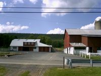
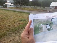
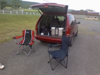
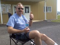
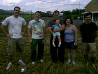
| − | Well my dad Frank and I head out to this location, getting there earlier than expected. We passed the place up the first time using only the | + | Well my dad Frank and I head out to this location, getting there earlier than expected. We passed the place up the first time using only the Google map satellite image, however on the way back we can spot the details immediately. We found ourselves off Route 80 a few miles which takes us right into a small Amish countryside. I call this a lucky spot. Not only was the hashpoint right next to the road, it was at the corner of a field next to the public recycling drop-off point. We waited in comfort of a few lounge chairs for other Geohashers to arrive. Fortunately, the rain held out the whole time, and at many points of the day we had a bit of sunshine. After some sandwiches, celery sticks, and beef jerky, [[User:CreativeEmbassy|Clint]] with family and friend arrived, passed up the point as well, then came back to meet us. After much greeting and celebrating of achieving our first Williamsport hashpoint, we took the necessary photo evidence of our arrival. |
===Photos=== | ===Photos=== | ||
| Line 55: | Line 41: | ||
==The State Park== | ==The State Park== | ||
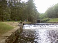
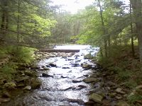
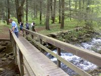
| − | After taking in the scenery some more we decided to move the party to the local state park. After turning into the wrong place twice I finally got the van to the picnic benches. Frank and I broke out some | + | After taking in the scenery some more we decided to move the party to the local state park. After turning into the wrong place twice I finally got the van to the picnic benches. Frank and I broke out some refreshments from all the essential food groups (Donuts, M&M's, Ham Sandwiches.) We had some important philosophical debates, quoted memes, and most importantly, threw things at each other. The park was very nice with a creek flowing through and bridges to cross over. Pictures! |
| + | |||
| + | ===[[User:CreativeEmbassy|Clint]]=== | ||
| + | |||
| + | There's not much I can really add, Jon gave a pretty complete description (with pictures). We weren't sure how prepared to come, and Jon and Frank ended up providing all of the snacks (we'll bring food next time, I swear!) Our first geohash was a blast, and we can't wait for the next one. | ||
===Photos=== | ===Photos=== | ||
| Line 66: | Line 56: | ||
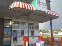
Image:May31Williamsport35.jpg| Right next to Ritas was a final treat. | Image:May31Williamsport35.jpg| Right next to Ritas was a final treat. | ||
| − | </gallery> | + | </gallery> |
Revision as of 03:03, 2 June 2008
| Sat 31 May 2008 in 41,-77: 41.0374871, -77.2812665 geohashing.info google osm bing/os kml crox |
Contents
About
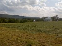
Google maps shows that it is in the corner of a farmer field right next to the road.
This location is in the Williamsport, PA graticule.
4:00PM Meetup
The following people are planning to attend the 4:00pm meet up:
- Jon plans to attend. With no GPS I'm relying on the Google Maps image. I'll look for people there!
Looks like we have rain on our hands.. I'm still heading up even if it means camping in my car/van!
- Clint and friends plans to attend.
Expedition
Jon
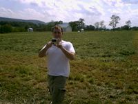
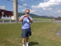
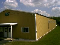
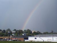
Well my dad Frank and I head out to this location, getting there earlier than expected. We passed the place up the first time using only the Google map satellite image, however on the way back we can spot the details immediately. We found ourselves off Route 80 a few miles which takes us right into a small Amish countryside. I call this a lucky spot. Not only was the hashpoint right next to the road, it was at the corner of a field next to the public recycling drop-off point. We waited in comfort of a few lounge chairs for other Geohashers to arrive. Fortunately, the rain held out the whole time, and at many points of the day we had a bit of sunshine. After some sandwiches, celery sticks, and beef jerky, Clint with family and friend arrived, passed up the point as well, then came back to meet us. After much greeting and celebrating of achieving our first Williamsport hashpoint, we took the necessary photo evidence of our arrival.
Photos
- Photos as the Williamsport Graticule Hashpoint
Jon as one of the photographers. In the expedition. For great justice.
Frank, Jon's dad, helps with photos.
The State Park
After taking in the scenery some more we decided to move the party to the local state park. After turning into the wrong place twice I finally got the van to the picnic benches. Frank and I broke out some refreshments from all the essential food groups (Donuts, M&M's, Ham Sandwiches.) We had some important philosophical debates, quoted memes, and most importantly, threw things at each other. The park was very nice with a creek flowing through and bridges to cross over. Pictures!
Clint
There's not much I can really add, Jon gave a pretty complete description (with pictures). We weren't sure how prepared to come, and Jon and Frank ended up providing all of the snacks (we'll bring food next time, I swear!) Our first geohash was a blast, and we can't wait for the next one.
