Difference between revisions of "2018-08-22 52 -1"
imported>DanQ (→Expedition) |
imported>DanQ (→Photos) |
||
| Line 66: | Line 66: | ||
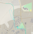
Image:2018-08-22 51 -1 track-log.png | Interesting bit of the track log: the walk around East Adderbury | Image:2018-08-22 51 -1 track-log.png | Interesting bit of the track log: the walk around East Adderbury | ||
</gallery> | </gallery> | ||
| + | |||
| + | More photos, in a higher resolution, and other goodies can be found at [https://danq.me/2018/08/22/2018-08-22-52-1/ https://danq.me/2018/08/22/2018-08-22-52-1/]. | ||
== Achievements == | == Achievements == | ||
Revision as of 20:30, 22 August 2018
| Have you seen our geohashing marker? We'd love to hear from you! Click here to say "hi" and tell us what you've seen!
Curious about what geohashing is? Read more! |
| Wed 22 Aug 2018 in 52,-1: 52.0189842, -1.3124316 geohashing.info google osm bing/os kml crox |
Location
Field with public footpath, East Adderbury.
Participants
Plans
I'm keen to get to level 2 of the Minesweeper Geohash achievement, and this far-South-of-graticule hashpoint represents an opportunity to achieve that. I'll be at work during the day, but - energy levels permitting after what'll have been a long day! - I'll find a way to get up here and see if I can get to the hashpoint, aiming to arrive probably around 18:30.
Expedition
It had been a long day at work, but it looked to be a beautiful evening and I promised myself a pub dinner if I made it to the hashpoint, so I set out by car and by foot to East Adderbury, the village nearest to the hashpoint. The village itself is stunning: lots of old stone buildings, a very traditional bridge, and beautiful green spaces. I spotted not one but two candidate pubs (The Red Lion and The Coach & Horses) as I passed through the village, which was a reassuring start, and then pressed on down a lane which quickly became a narrow trail, waving to some cows along the way (why do I always seem to meet cattle on my hashing adventures?).
The trail was full of blackberries so I wasn't short of a snack, but it soon became clear that it wouldn't get me any closer than 35m to the hashpoint. I returned to the entrance to the cows' field and, hopping a stile, crossed it. The cows looked puzzled as I paced around, getting to ground zero, but didn't object. After shooting the traditional silly grin, I turned tail and headed back into the village and to the Coach & Horses, which proved to be the very essence of a British village pub: a husband and wife couple running it, dogs everywhere, a jar of pickled onions behind the bar, and more beers than you can shake a stick at.
I did enjoy a rather unusual conversation at the bar, though -
 Me: Can I get a ham, egg, and chips please. And a pint of bitter shandy.
 Barman: One egg or two?
 Me: Oh! Two, please.
 Barman: (Pause) We haven't got any eggs.
 Me: Uhh. Okay; no eggs then.
 Barman's wife: We've got one egg.
 Barman: We've got one egg.
 Me: I'll have one egg, then.

 (I go and sit outside; after a while, my meal arrives. There are two eggs.)

 Barman's wife: I found another egg.
 Me: ...
A fuller description of the entire adventure can found in the vlog I made along the way.
Tracklog
Video
I filmed my adventure in a vloggy format, complete with doubling-back, talking to cows, and anecdotes about pub food. Watch it on YouTube.
Photos
More photos, in a higher resolution, and other goodies can be found at https://danq.me/2018/08/22/2018-08-22-52-1/.
Achievements
Dan Q achieved level 2 of the Minesweeper Geohash achievement
|


