Difference between revisions of "2020-07-25 53 10"
m (clearing up username confusion) |
(→Photos: photos 51 of 120) |
||
| Line 12: | Line 12: | ||
==Photos== | ==Photos== | ||
| − | + | <gallery> | |
| − | + | File:2020-07-25 53 10 1.JPG | proof 1 (phone didn't take pictures) | |
| + | File:2020-07-25 53 10 2.JPG | proof 2 | ||
| + | File:2020-07-25 53 10 3.JPG | the hash | ||
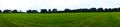
| + | File:2020-07-25 53 10 4.JPG | pano 1 | ||
| + | File:2020-07-25 53 10 5.JPG | pano 2 | ||
| + | File:2020-07-25 53 10 6.JPG | π π π | ||
| + | File:2020-07-25 53 10 7.JPG | π π π's mum | ||
| + | File:2020-07-25 53 10 8.JPG | our bikes | ||
</gallery> | </gallery> | ||
Latest revision as of 20:23, 16 January 2022
| Sat 25 Jul 2020 in 53,10: 53.7735488, 10.0730584 geohashing.info google osm bing/os kml crox |
Location
on a meadow in Wakendorf II, Schleswig-Holstein
Participants
Expedition
My mother wanted to come along for this hash, which was located in Wakendorf II, the last of the nine towns I vowed to do every hash in that I hadn't visited. We took off on our bikes in the afternoon and cycled 6 km along a railway-track-turned-trail, then another two kilometres or so to the hash. It lay 90 m onto a big, empty meadow, but we had to cross a small ditch and avoid some nettles to get there. I easily found the hashpoint, took photos and laid an x on the ground with mown grass, then we walked back to our bikes along the street. We took another way home, which was a little shorter, and found a geocache along the way, though sadly we had no pencil and could't log it. We arrived home after cycling around 17 km.
Photos
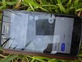
proof 1 (phone didn't take pictures)
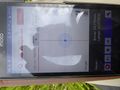
proof 2
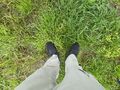
the hash
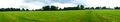
pano 1
pano 2
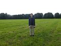
π π π
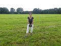
π π π's mum
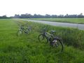
our bikes


Achievements
Land geohash, Bicycle geohash, Drag-along achievement?
This user earned the xkcd Nullaturion achievement
|
I just noticed that we left at exactly 4 pm, so this is my first actual Saturday meetup (on the tenth Saturday hash)! I never bother about the time because there has never been another geohasher at a geohash before I arrived or after I left.