2011-07-07 51 12
From Geohashing
| Thu 7 Jul 2011 in 51,12: 51.2046508, 12.5256724 geohashing.info google osm bing/os kml crox |
Location
On a path between two small ponds ... we thought.
Participants
Expedition
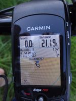
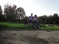
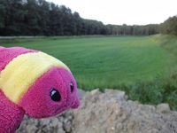
Reinhard drove to Leipzig after work to visit Manu and to go on a geohash bike ride together with her. 45 km could easily be done before sunset and the hash promised a short bath in a small lake or pond. Reaching the hashpoint was really simple, but both ponds that can be seen in the google satellite view were dry and covered with grass. This was especially disappointing, because Frère Krabbe (brother crab) wanted to start his first geohashing expedition with a swim in a lake. Maybe a better water hash will come soon and he gets a 2nd chance. For today he had to be content with the bathtub.
Photos
|


