2016-05-03 63 29
| Tue 3 May 2016 in 63,29: 63.6266169, 29.0918594 geohashing.info google osm bing/os kml crox |
Location
In Nurmes, Ylikylä. The point lies on a rocky patch of pine trees.
Participants
- Pastori
- The Wife
Plan
A hashpoint in a remote village in a town in the neighbouring graticule was calling out to Pastori and Wife. An almost summery +16 degrees Celsius was still warming the inhabitants of Northern-Karelia and Pastori and Wife were happy to go for a drive in the partly cloudy weather. Their geo-vehicle (a Toyota Yaris) was loaded full of junk they'd uncovered during a bit of spring cleaning. They were going to take the junk to the recycling centre while they were at it.
Expedition
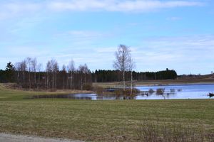
The drive passed nicely while watching migratory birds and marvelling at spring and so they found themselves near the point, 180 metres away, in no time at all. There was still a tiny patch of snow at the edge of the field but that didn't slow them down and neither did the rocky ground. Pastori and Wife successfully navigated the jagged rocks and found the point at an accuracy of 0.435 metres in a group of pine saplings. On the way back to the car, Pastori was delighted smelling the lovely summery scent of the first birch bud he'd seen this spring.
On they went to the recycling centre where they dumped their junk and bought two new birdhouses, made from recycled materials. They houses are very nice, hopefully the birds think so too.
All in all there was 99 km of driving, 400 m of walking and a 4 and a half hours spent on the whole trip.
Additional photos
Achievements
Pastori & The Wife earned the Land geohash achievement
|


