2010-08-17 52 1
| Tue 17 Aug 2010 in Norwich: 52.7146890, 1.6946664 geohashing.info google osm bing/os kml crox |
Contents
Location
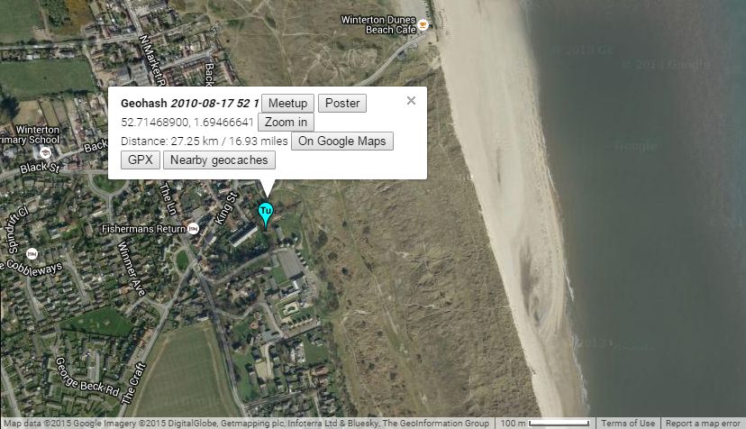
In a nettle patch behind the sand dunes at Winterton on Sea, Great Yarmouth, UK. There is a GPS path on Wikiloc.
Participants
Expedition
Sourcerer (Neil) visited this haspoint as it was close enough to the dog food shop he was visiting. With a 15kg bag of Turkey and Rice Kibble in the boot, he drove north to Winterton passing a signpost to California. He got to within 14 metres of the exact point and was well inside the circle of uncertainty of his GPS receiver. The terrain was uneven waste land covered in tall vegetation and nettles. The site differed from the Google Earth image which showed marine sand dunes merging into dry land vegetation. In reality, there were new houses, not yet occupied, and new holiday chalets. This was a beach geohash and could have been wonderful but the English weather was cool and dull.
Expeditions and Plans
| 2010-08-17 | ||
|---|---|---|
| Tōkyō, Japan | starbird | In a park in Shimo-Ochiai, a neighborhood of Tokyo between Shinjuku and Ike... |
| Newark, New Jersey | Jevanyn | Stelton Rd., Edison |
| Cleveland, Ohio | jSchleappi, Many Someone elses? | The official hash is in someone's backyard, so an alternate meet up locatio... |
| Portland, Oregon | Jim | On McGuire Island SE of Goverment Island in the Columbia River |
| Norwich, United Kingdom | Sourcerer | In a nettle patch behind the sand dunes at Winterton on Sea, Great Yarmouth... |
| Middlesbrough, United Kingdom | Someone went | Somewhere |
Sourcerer's Expedition Links
2010-08-13 52 1 - 2010-08-17 52 1 - 2010-08-27 52 1 - KML file download of Sourcerer's expeditions for use with Google Earth.
