File:200921002 34 -84NW13.JPG
From Geohashing
Revision as of 18:10, 14 February 2010 by imported>AperfectBot (Robot: Adding Category:GPS_receivers)
No higher resolution available.
200921002_34_-84NW13.JPG (640 × 480 pixels, file size: 139 KB, MIME type: image/jpeg)
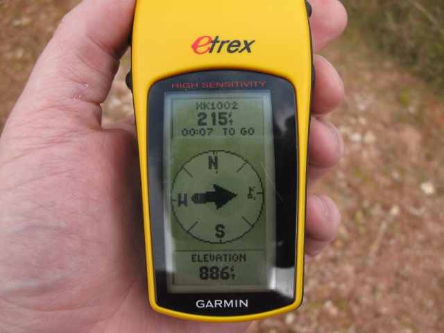
886 feet at the top of the hill. A rise of 56 feet at 215 feet away. Okay basic geometry, what is the slope of the hill???
File history
Click on a date/time to view the file as it appeared at that time.
| Date/Time | Thumbnail | Dimensions | User | Comment | |
|---|---|---|---|---|---|
| current | 15:28, 30 January 2020 | | 640 × 480 (139 KB) | Maintenance script (talk | contribs) |
- You cannot overwrite this file.
File usage
The following page links to this file: