Difference between revisions of "2008-07-02 51 -2"
From Geohashing
imported>Bluecont (New page: {{meetup graticule | map=<map lat="51" lon="-2" date="2008-07-02" /> | lat=51 | lon=-2 | date=2008-07-02 }} ==Location== A field on the outskirts of Banwell, North Somerset. ==Report== [[...) |
imported>Bluecont |
||
| Line 17: | Line 17: | ||
==Photos== | ==Photos== | ||
<gallery widths="200px" heights="160px" perrow="2"> | <gallery widths="200px" heights="160px" perrow="2"> | ||
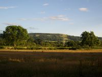
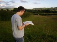
| − | Image:2008-07-02_51_-2_Mendips.JPG|The Mendip Hills provided a stunning background | + | Image:2008-07-02_51_-2_Mendips.JPG|The Mendip Hills provided a stunning background. |
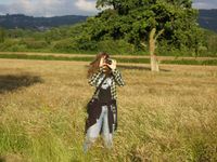
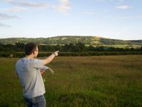
| − | + | Image:2008-07-02_51_-2_Photo.JPG|Mirror via photography | |
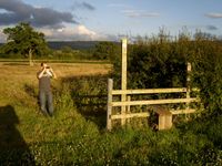
| − | Image: | + | Image:Stile%2Bgoldcont.JPG|The stile was the most exciting object near the geohash. So [[user:Golcont|Goldcont]] took a picture of it. |
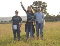
| − | Image: | + | Image:2008-07-02_51_-2_Group1.JPG|Proof that we were all here at once! |
| − | Image: | + | Image:2008-07-02_51_-2_Goldcont-here.JPG|[[user:Goldcont|Goldcont]] proclaims the spot to be exactly here! |
| + | Image:2008-07-02_51_-2_Bluecont-ummJPG.jpg|[[user:Bluecont|Bluecont]] considers matters breifly... | ||
| + | Image:2008-07-02_51_-2Bluecont-or.JPG|and slightly disagrees. | ||
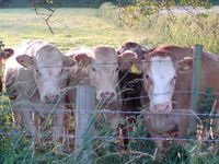
| + | Image:2008-07-02_51_-2-Cows.jpg|The cows came to wave at us as we passed, so they had to be documented... just in case. | ||
</gallery> | </gallery> | ||
[[Category:Expeditions]] | [[Category:Expeditions]] | ||
[[Category:Expeditions with photos]] | [[Category:Expeditions with photos]] | ||
Revision as of 18:07, 3 July 2008
| Wed 2 Jul 2008 in 51,-2: 51.3212162, -2.8560437 geohashing.info google osm bing/os kml crox |
Location
A field on the outskirts of Banwell, North Somerset.
Report
Bluecont, Goldcont and 414e54484f4e5942 decided to have an impromptu adventure! Seeing that today's hash was close by and readily accessible: we went.
We parked on a major road nearby, and had a small walk to the spot itself. Lacking a hand-held GPS system we had to determine our location using a compass and a map! We then took photographic evidence and left. On the way back we were (possibly) interrogated by some curious cows.
