2010-08-23 49 8
| Mon 23 Aug 2010 in 49,8: 49.4004031, 8.7646588 geohashing.info google osm bing/os kml crox |
Location
In the Odenwald, at the Auerhahnenkopf hill, between Heidelberg and Neckargemünd.
Participants
Expedition
The coordinates were only 6.1 km as the crow flies from where I live, but deep in the Odenwald forest. I wanted to try a Juggernaut expedition, which required to cross the top of the Königstuhl and climb more than 450 elevation meters. Since a deviation of more than 300 m would have invalidated the achievement, I tried to stick to the hiking trails leading most directly to the top of the Königstuhl, leaving those trails from time to time when they would have caused me to deviate too much. Luckily there wasn't much undergrowth to fight my way through.
I reached the coordinates and found the hashpoint to be on the trails of heavy forest machinery, with trees cut down and branches crushed everywhere around. It couldn't have been a more appropriate location for a Juggernaut achievement.
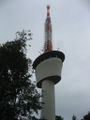
Visiting the viewing platform of the Königstuhl on my way to the hashpoint would have put me into the danger of invalidating the Juggernaut achievement, so I went there on my way back (instead of going downhill for a more convenient walk home). Even though it was cloudy and rainy, the view was nice and rewarding.
Tracklog
http://www.everytrail.com/view_trip.php?trip_id=772876
ilpadre earned the Walk geohash Achievement
|
ilpadre earned the Juggernaut achievement
|
Photos
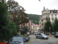
Hashpoint is behind a hill behind that hill.
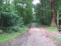
One of the more comfortable trails.
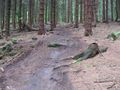
One of the less comfortable trails.
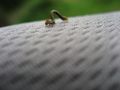
Caterpillar on my shoulder.
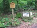
There are many parting stones in the Odenwald, most of them hundreds of years old.
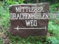
"Middle Dragon's Cave Way"
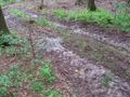
The coordinates. I'm not kidding.
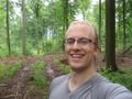
Obligatory.
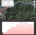
Juggernaut achievement. Red line: straight line from where I started (red arrow) to the hashpoint. Blue line: The way I walked. Yellow line: Maximum deviation. Bottom graph: Elevation profile along the blue line.
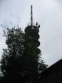
On top of the Königstuhl.
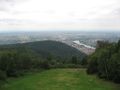
View from the Königstuhl. I came from behind that hill.


