Difference between revisions of "2015-04-19 global"
imported>Fippe m (correct graticule) |
m |
||
| Line 153: | Line 153: | ||
[[Category:Globalhash]] | [[Category:Globalhash]] | ||
| − | [[Category:Meetup on 2015-04-19]][[Category:Meetup in 37 -87]] | + | [[Category:Expeditions]] |
| + | [[Category:Meetup on 2015-04-19]] | ||
| + | [[Category:Meetup in 37 -87]] | ||
[[Category:Coordinates reached]] | [[Category:Coordinates reached]] | ||
{{location|US|KY|OH}} | {{location|US|KY|OH}} | ||
Latest revision as of 14:57, 22 September 2021
|
Globalhash on Sun 19 Apr 2015: |
Location
- In the Evansville, Indiana graticule, (near Hartford Kentucky).
- This hashpoint was .25 of a mile in to the woods of a rock quary
Participants
NWoodruff
- Coordinates Reached! My Second Global Geohash. I am the most active GlobalHasher.
Sitting at my desk at work, most times, I start eyeing my email at about 9:35am. My email notify program usually sends out mail between 9:37 and 9:40am. If you haven't tried it, you should. It is at http://xkcd.nathanwoodruff.com/Notify.aspx The email popped up and I was hoping that there would be a Saturday Geohash that would be reachable.
On Fridays, I usually get about 1 or 2 locations sent to me that are close by. This email had 3 locations listed in it. I thought... Wow.. Lucky, I'll be able to geohash every day this weekend. Fridays Geohash was only 5 miles from my house. Saturdays Geohash was a little farther at 21 miles. Still acceptable. I then looked at Sundays geohash and it said 28.1 miles away. I though strange that I had set the notification at less than 25 miles. I thought that there must be something wrong with the program and I would look at it when I got home.
I then took another glance at it and notice something wrong. There was no period in the number. The number was 281 miles. How could that be???? I took a look at the link. For local Geohashes I provide a link to carabineer map. But for Global Hashes I provide a link to Google maps. I quickly looked at the link, it was a google maps link. I said "No way". I quickly clicked on the link hoping that it wouldn't be in the Atlantic Ocean.
Kentucky... I was in business. I didn't have anything to do on Sunday either. I quickly zoomed to the global hash spot. There are roads near by. It looks like a trek into the woods of about .25 of a mile but that should be fine. I decide that instead of driving my own truck, I would rent a car that got great gas mileage and I would have to do that Saturday morning.
I got home from work on Friday and grabbed the geohash that was 4 miles from my house as kind of a warm up.
Saturday morning I get up I get up early to finish that morning what I need to do in order to have the entire Sunday to myself. I get home about 11 am on Saturday and I rush out to go rent a car as the rental place is only open till 12 noon on Saturday. The great thing is that they don't open back up till Monday morning so in all actually, you get a car for two days for the price of one day.
I transfer all my stuff that I need for geohashing and as a trial attempt make a dash for Saturday's official geohash as a trial run in a different graticule. I make it with out problem. I then return home and start planning for tomorrows great geohash.
I study google maps and how to get there. I study the actual location to make sure that it will be reachable, I would hate to drive that far for it not to be reachable. I usually try to plan a route if it involves rivers or a body of water. I print out road maps of the area just in case my original route leads to a not possible. That way with the maps I might be able to approach it from a different road.
Since I also have a web page that will generate a .gpx from any two points on a map, this time I also bring a lap top because my cell phone does not have a serial port to talk with the eTrex. I enter the two points on the cell phone, download the generated .gpx from my website to the cell phone and then transfer it to my lap top. Then the lap top transfers it to the eTrex. I made sure that I was going to reach the point.
There does appear to be a small river that could be in my way, so I pack a extra set of pants and socks just in case for some reason I do get wet. I don't want to drive all the way home in soggy clothes.
From google maps it appears to be .25 of a mile off of a public road. I can tell that there is some kind of digging going on as it appears that there are some deep holes in the ground filled with water. I live with in a mile of a rock quarry and looking at google maps at my house the holes in the ground look similar. The digging appears to be on the other side of the road so I am hopeful that I will be fine.
I don't sleep well Saturday night. I wake up several times and look at the alarm clock. I didn't set a time but I usually wake up about 6:30 am every morning to go to work. I think I woke up a 3, 4 and 5 am, each time wondering if I should go ahead and start the trip. I wanted to get enough sleep to where I wasn't falling asleep behind the wheel, but not so much sleep that I was making it there by night fall. I was originally planning to leave by 9am.
7pm rolled around and I decided to get up and get on my way even though it was a strong thunderstorm outside. I went over my stuff in the car and made sure that I had everything, even including a whole pack of new batteries.
I set off following my eTrex. Each geohash that the notify program sends out includeds a .gpx file. The one problem is that for global hashes, there are too many trackpoints for the eTrex to handle. My etrex and only take 10,000 track points. There were almost 12,000 track points to the global hash so I had to trim out the first hour and a half of driving. I would only have the course points of where I needed to turn. I could then start following the tracklog about 20 miles south of Nashville Tennessee.
I know Georgia roads very well and have traveled to Chattanooga Tennessee several times, which is just over the boarder of Georgia. So I should be fine getting to Nashville. I did make it to Chattanooga fine but if you look at my track log you will find a few places where I made wrong turns and had to double back. I was busy looking at the mountains and scenery and didn't notice that I picked up the track log until after Nashville.
It had been raining heavily off and on my entire trip and I was starting to worry would I make it to the hash spot if it was down pouring. I would like to think that I would but heavy rain trekking through unknown woods might change my trip to a not reached because of weather. I was becoming concerned.
I was glad to see Kentucky. But, I was also amazed to how few people were on the road. Being from the largest city in the South East, I am used to constant traffic and rarely if ever to I get on a road and see nobody. Well, that is unless it is Thanksgiving or Christmas day.
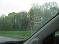
When I get off the interstate and turn on to back roads, I see a sign warning that the next exit to the parkway is 24 miles away. I though about stopping for gas but I knew I had enough in the tank to make it 24 miles. I drove the next 24 miles with out passing or seeing any cars on the road. That may not be unusual for Kentucky but it was unusual for me.
The next exit 24 miles away did not have a gas station at it. Neither did the next exit 18 miles away. Just passing that exit the low gas light comes on, I had 14 miles to the last exit, can I make it?
If you follow the track log of my trip you can see as soon as I turn off the last limited access road, I turn directly into a gas station. It was closed. They are closed on Sunday. I have never seen a gas station closed on Sunday. A first for me. I go across the street to a fire house and ask where the nearest gas station is. There is only one open on Sunday. It is on the other side of the small town, about 2 miles away. Luckily it was on my path to the geohash spot.
I pull into the station on fumes. I fill up and get something to drink. It was a steady drizzle rain the entire time of driving through Kentucky. As I got back in the car after filling up, it started to rain so hard that visibility was limited. I sat there for 5 minutes waiting for it to slow.
I look at my etrex and it looks to be about 10 to fifteen miles away. I get to the edge of town less than a mile away and turn on the last major road. As I do this the sun comes out. A good sign.
The last road that I turn on is a dirt road with gravel stone. I am now following the track log from google maps and it says now to turn at this dirt field. Google maps must be a few years old because it appears that they had moved that road. I am now driving through this muddy field dodging piles of dirt. I become fearful that the car is going to get stuck. I turn around and follow the tire track in the mud back out to the gravel road.
I look at my printed google map and deem that it is worthless as it is out of date. I turn on the gravel road in hopes that I don't have to walk a mile and some through the dirt field to the hash spot. I go on the gravel road and pass 2 bulldozers and a huge 8 yard bucket front end loader parked sitting 20 feet off of the gravel road. I had driven one of those around an asphalt plant 20 or so years ago working for an asphalt company. I wonder if I could drive that thing to the geohash spot. There was nobody around for miles. I decide that I wouldn't try it.
I drive for another couple of hundred yards and come to the bottom of the hill. I decide that this is the closest I am going to get driving to the hash spot. I get out and look for a good way to make it to the hash spot. There is a dirt berm about 5 feet high on either side of the road. I climb up on it and I see a river. It looks to be about 2 or three feet across. I don't know if it is always there or from all the rain that had happened today. I walk down the side of the hill looking for a way to cross it and don't find a good way. I look farther down the road and it appears that from the top of the next hill would be a good way around the river. I make my way back to the car and drive a few more hundred yards up the next hill.
I stop at the top and get out and change shoes as I knew I would be walking in the mud. I assumed that this was a public road from google maps and didn't think anything about the car that drove past as I was changing shoes. It stopped down the road than turned back. It was an older man, well older than me and asked if I was having trouble. I said "No, I am from the internet and looking for a spot. I'm fine." He said "Okay" and drove on his way.
I once again climb over the 5 foot dirt berm and start making my way through the thick brush following the arrow in the eTrex. It started out at .24 of a mile and there were several hills and valleys that I would have to climb up and down. I started again to have my doubts about making it. I trekked on inch by inch fighting the thick brush. I finally came to a clearing .10 of a mile to go. It probably took 15 minutes to make that .14 of a mile. Once through the clearing I came on a washed out dirt road. 500 feet to go. I thought I'm going to make it.
The mud was thick on this washed out dirt road. But 500 feet turned into 400 feet, then 300 feet, then 200 feet. Looking out into the field and down the dirt road I was trying to eye where the global hash spot would be. By that time I knew by hell or high water, mostly high water, I was going to make it. I looked back at the eTrex, 100 feet. 80 feet, 50 feet, I could see where the Global hash spot would be. I knew that I would make it. 32 feet, I'm inside of the 10 meter requirement. I made the last few feet till I reached 2.34 feet to go. My second Global Hash.
It started to sprinkle again. I started taking pictures to verify that I was there. I started to look for sticks to make an XKCD marker. I found a few and had to break them into pieces. It then started to rain heavily.
I took a picture of the XK and started making my way back on the washed out dirt road. I assumed that this dirt road would eventually lead to the gravel road. There was no way I was going to make my way back through the thick brush in the rain.
It was hard going but I eventually made it back to the dirt berm that had covered up that there once was a dirt road there. About 5 feet before the dirt berm blocking the path to the gravel road there was a sign that said "All visitors must check in at the front office." It wasn't a no trespassing sign. I never saw a front office either.
I climbed again over the dirt berm and made my way back to the car. I was soaked from the rain. I get in the car and start loading pictures and the track log to my website for safe keeping. The rain had died down by the time that I finished. I got out and took one last picture with the Global #2 sign. It is on the front page and you can see all the black clouds in the background that rolled through. I change clothes right there on the side of the road. I strip down to underwear and get dry clothes out of the trunk. I change out of underwear once I had a shirt on but though I probably could walk around nakked as there was nobody around for miles.
I put all the wet stuff in the trunk and get back into the vehicle. The upload of my data finishes. Another car drives by and stops. It was a younger couple. They stop and ask if I am stuck. I say, "No I am here just uploading data and when I'm done I'll be on my way." I had my phone connected to my laptop and the guy asks, "Do you get better reception on your laptop up here?" referring to be at the top of the hill. I said that I use my phone to connect to the internet. He said, "Oh, okay". I wasn't sure if he knew that you could access the internet via a phone. Rural Kentucky may only have dial up still, you never know. They drove off.
I drove back in to Hartford. I got something to eat and enjoyed the small town atmosphere. I sat there thinking I just did my second global hash and wondered if I was ever going to do another one. I took my time eating.
I then got in the car and made the long trek back to Norcross Georgia. I got home slightly after 10pm EDT.
Here is my GPX Tracklog... [1] and can be viewed after downloading with this... http://gpxviewer.1bestlink.net/
NWoodruff Gallery
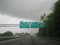
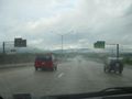
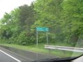
Nashville Tennessee, 125 miles away.
What??? Back in Georgia? Am I going the right way?
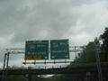
Well, I think I am going the right way.
Okay.. I was worried for a moment.
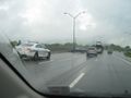
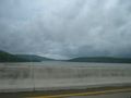
The famous Tennessee River.
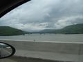
River to the right.
River to the left.
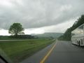
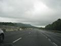
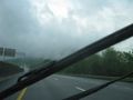
More mountains to driver over.
Great view.
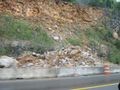
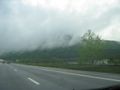
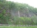
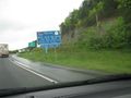
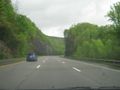
Rock slide.

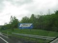
Remember that 20oz coke that you started off with??? Yea... rest area.
Ahhh... refreshed.....
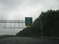
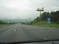
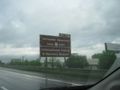
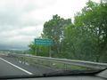
Nashville 79 miles.
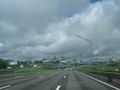
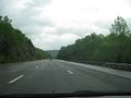
Nashville, Here I come.
More Nashville.
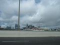
The Tennessee Titans stadium.
I've made it to Kentucky.
Bowling Green Kentucky. The Corvette Museum. I didn't stop though.
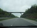
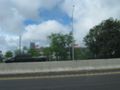
Cool looking bridge.
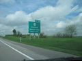
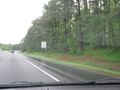
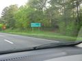
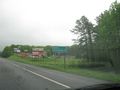
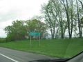
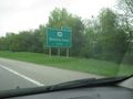
Hartford Kentucky. Where I am headed to.
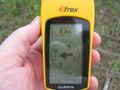
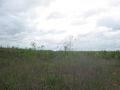
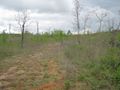
As close as I could get from the road.
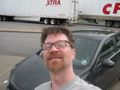
I made it. The money Shot.
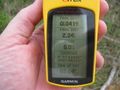
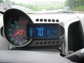
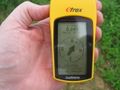
Time of day.
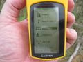
Date and time.
Looking West standing on the GlobalHash point.
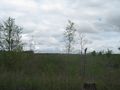
Looking East standing on the GlobalHash spot.
Looking South standing on the GlobalHash spot.
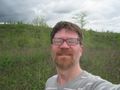
Looking North standing on the GlobalHash spot with a Stupid Grin™

Am I flashing the universal Peace sign? Nooo... that is 2... 2 fingers for my SECOND GLOBALHAHS!!
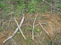
I was going to spell out XKCD with sticks but as I was looking for more sticks to make a C, the sky opened up with a downpour. So I took a picture and left it with XK.
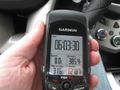
6 hours 3 minutes and 30 seconds to drive 385.4 miles from my house to the GlobalHash spot.


Awards
NWoodruff earned the Globalhash achievement
|
