Difference between revisions of "2016-07-09 42 -71"
From Geohashing
([retro picture]Here at the hashing, six years late. [https://openstreetmap.org/?mlat=42.36355060&mlon=-71.07758530&zoom=16 @42.3636,-71.0776]) |
([retro picture]Another angle on the hashpoint. [https://openstreetmap.org/?mlat=42.36354742&mlon=-71.07755620&zoom=16 @42.3635,-71.0776]) |
||
| Line 28: | Line 28: | ||
Image:2016-07-09_42_-71_JesseFTW_1657381528059.jpg|Here at the hashing, six years late. [https://openstreetmap.org/?mlat=42.36355060&mlon=-71.07758530&zoom=16 @42.3636,-71.0776] | Image:2016-07-09_42_-71_JesseFTW_1657381528059.jpg|Here at the hashing, six years late. [https://openstreetmap.org/?mlat=42.36355060&mlon=-71.07758530&zoom=16 @42.3636,-71.0776] | ||
| + | |||
| + | Image:2016-07-09_42_-71_JesseFTW_1657381701195.jpg|Another angle on the hashpoint. [https://openstreetmap.org/?mlat=42.36354742&mlon=-71.07755620&zoom=16 @42.3635,-71.0776] | ||
</gallery> | </gallery> | ||
Revision as of 15:48, 9 July 2022
| Sat 9 Jul 2016 in 42,-71: 42.3635402, -71.0775782 geohashing.info google osm bing/os kml crox |
Location
Right by the Charles River, along Cambridge Parkway near the floating wetland.
Participants
Plans
Six years late, to the day, I plan to head over and grab some pictures. JesseFTW (talk) 13:20, 9 July 2022 (UTC)
Expedition
Photos
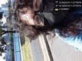
Here at the hashing, six years late. @42.3636,-71.0776
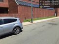
Another angle on the hashpoint. @42.3635,-71.0776

