Difference between revisions of "2017-07-25 31 35"
m (Location) |
m |
||
| Line 63: | Line 63: | ||
<!-- Add any achievement ribbons you earned below, or remove this section --> | <!-- Add any achievement ribbons you earned below, or remove this section --> | ||
| − | |||
| − | |||
| − | |||
| − | |||
| − | |||
| − | |||
| − | |||
| − | |||
| − | |||
| − | |||
| − | |||
| − | |||
| − | |||
| − | |||
[[Category:Expeditions]] | [[Category:Expeditions]] | ||
| − | |||
| − | |||
| − | |||
| − | |||
| − | |||
[[Category:Expeditions with photos]] | [[Category:Expeditions with photos]] | ||
[[Category:Coordinates reached]] | [[Category:Coordinates reached]] | ||
| − | |||
| − | |||
| − | |||
| − | |||
| − | |||
| − | |||
| − | |||
| − | |||
| − | |||
| − | |||
| − | |||
| − | |||
| − | |||
| − | |||
| − | |||
| − | |||
| − | |||
| − | |||
| − | |||
| − | |||
| − | |||
{{location|IL|YS}} | {{location|IL|YS}} | ||
Latest revision as of 12:12, 23 September 2021
| Tue 25 Jul 2017 in 31,35: 31.8374110, 35.1821660 geohashing.info google osm bing/os kml crox |
Location
A forest near Nebi Samuel, West Bank, Israel. Nebi Samuel is the traditional Arabic name for the prophet Samuel who is buried there with his father Elkanah and his mother Hanah. We'll see if this hash is holy enough to qualify.
Participants
Plans
Take the bus to a point near the mausoleum. Explore the mausoleum, pray, read from the Book of Samuel and then go on to the hash.
Expedition
Everything went as planned. I stopped at the Mausoleum, prayed and read chapters from the book of Samuel and then hiked out to hashpoint. I then walked back to the highway and followed the highway back to Ramot, Jerusalem where I took a bus to the Jerusalem Central Station.
Tracklog

Photos
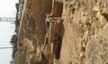
An archaeological dig next to the mausoleum
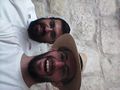
I met Yehuda at the mausoleum
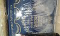
Moses and Aaron and his priests and Samuel calls his name.
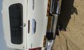
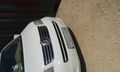
Education: Israelis have cars with Israeli license plates.
Education: Palestinians have cars with Palestinian license plates.
Here are the villages on the other side of the fence: the Bible calls this area Giv'on, the Arabs decided to be creative with that name and call it Jib because Levantine Arabs can't say 'g'. In other news they also can't say 'p'.
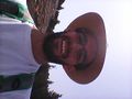
Here I am at the hashpoint.
The security road next to the hashpoint


Achievements
This was about 400 meters away from a holy hash. Not holy enough.