Difference between revisions of "2017-09-25 31 34"
From Geohashing
imported>FippeBot m (Location) |
m |
||
| Line 55: | Line 55: | ||
Delete the next line ONLY if you have chosen the appropriate categories below. If you are unsure, don't worry. People will read your report and help you with the classification. --> | Delete the next line ONLY if you have chosen the appropriate categories below. If you are unsure, don't worry. People will read your report and help you with the classification. --> | ||
| − | + | [[Category:Expeditions]] | |
| − | |||
| − | |||
| − | |||
| − | |||
| − | |||
| − | |||
| − | |||
[[Category:Expeditions with photos]] | [[Category:Expeditions with photos]] | ||
| − | |||
| − | |||
| − | |||
| − | |||
| − | |||
| − | |||
| − | |||
[[Category:Coordinates reached]] | [[Category:Coordinates reached]] | ||
| − | |||
| − | |||
| − | |||
| − | |||
| − | |||
| − | |||
| − | |||
| − | |||
| − | |||
| − | |||
| − | |||
| − | |||
| − | |||
| − | |||
| − | |||
| − | |||
| − | |||
| − | |||
| − | |||
| − | |||
{{location|IL|M|RH}} | {{location|IL|M|RH}} | ||
Latest revision as of 12:26, 23 September 2021
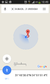
| Mon 25 Sep 2017 in 31,34: 31.8105436, 34.8642875 geohashing.info google osm bing/os kml crox |
Location
A field near Yesodot, Israel and highway 3.
Participants
Plans
An easy bus ride to Yesodot Junction and then a short half kilometer walk to the hashpoint.
Expedition
The expedition was boring as expected. It looked so boring that I didn't want to do it, but I was kind of hyper and didn't think I would concentrate on coding so I took the 451 bus one stop to Yesodot. At the very least I met Pinchas who happened to be an interesting conversationalist.
Tracklog
Photos

Pinchas and I on the bus

Arrival at the orange grove
proof


