Difference between revisions of "2017-11-28 31 35"
m (Location) |
m |
||
| Line 53: | Line 53: | ||
<!-- Add any achievement ribbons you earned below, or remove this section --> | <!-- Add any achievement ribbons you earned below, or remove this section --> | ||
| − | + | [[Category:Expeditions]] | |
| − | |||
| − | |||
| − | |||
| − | |||
| − | |||
[[Category:Expeditions with photos]] | [[Category:Expeditions with photos]] | ||
| − | |||
| − | |||
| − | |||
| − | |||
| − | |||
| − | |||
| − | |||
[[Category:Coordinates reached]] | [[Category:Coordinates reached]] | ||
| − | |||
| − | |||
| − | |||
| − | |||
| − | |||
| − | |||
| − | |||
| − | |||
| − | |||
| − | |||
| − | |||
| − | |||
| − | |||
| − | |||
| − | |||
| − | |||
| − | |||
| − | |||
| − | |||
| − | |||
{{location|IL|YS}} | {{location|IL|YS}} | ||
Latest revision as of 12:29, 23 September 2021
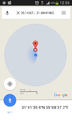
| Tue 28 Nov 2017 in 31,35: 31.6944106, 35.1436766 geohashing.info google osm bing/os kml crox |
Location
A field near Sde Boaz, Israel
Participants
Yosef (talk) 04:59, 29 November 2017 (UTC)
Plans
Take the 160 bus to Neve Daniel and then walk through the town to Sde Boaz. From there continue to be able to see the town and then head around the village because it will be my first time there.
Expedition
I was actually pretty excited for this one. There hadn't been an accessible hashpoint in Gush Etzion for a long time, but I really like the area. It looked reasonably safe and quite green so I got on the 380 bus from the Central Bus Station (they changed the numbers) and traveled south to Neve Daniel. From there I walked through the town from south to north verifying with the guard that he would open the gate for me at the northern exit to the town to Sde Boaz. From there I walked through Sde Boaz mainly just to see the town. When I got to the northern side of the 100 person town, I turned west and curved around on agricultural land to walk down to the hash point. The terraces were not very high, only about a meter and a half, and I eventually met up with a road on the southern side of the town. From there I had to navigate using the sun and I didn't realize that the sun is in the south at mid-day when in the northern hemisphere so I was a little confused at the beginning. Eventually I got to the point, sat down, read the prophecy of Ezekiel 36 ("You the hills of Israel") and headed back more or less the way I came.
User:Yerushalmi is right. Geohashing in Israel can be a real spiritual experience.
Tracklog
Photos
proof

proof

