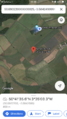
2020-05-17 50 -3
| Sun 17 May 2020 in 50,-3: 50.6932245, -3.5842512 geohashing.info google osm bing/os kml crox |
Location
In a field somewhat southwest of Ide.
Participants
Plans
This one and Saturday's are very close so I'll try to get to both of them at around 4pm. However, it looks like it isn't public access so I may not reach it.
Expedition
Departed around 15.30 and cycled to the southwest of Exeter. Dunsford Road was, as always, a difficult climb but was rewarded with the ride down Little John's Cross Hill.
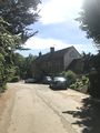
Descended into the Alphin valley, a place of some significance in my personal history. Passed The Twisted Oak and came to the Alphin Brook itself where I took a brief detour to explore downstream. Crossed the curly-wurly bridge into Ide, which turned out to be a rather nice village, and turned to head into the fields.
Followed the road as far as I could and ultimately got within 650m of the geohash. According to Google Maps, I could have gone further but it turns out the rest of the road was private property. A house at the end of a side road, which I think was a holiday home, was playing really loud music but I wasn't able to get a good recording.
Attempted to go around another route to get closer to the geohash. Along the way I met some friendly cows. This road also ended in private property but I was able to get within 450m of the geohash this time. I left this area mostly unpowered and my bike went surprisingly fast given the gentle slope.
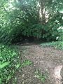
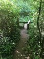
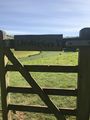
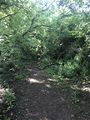
Passed a tunnel I had somehow missed on the outward journey. Just before it was a gap in the hedge leading up to the top of the tunnel, with a steeper route down the other side. These paths also lead away from the road through a small forest, eventually joining a walking trail. Took the stupid grin photo here. The main walking route opened onto the fields through a gate mysteriously inscribed with 'Underfore 1'. In the other direction it lead deeper into the forest, where I would have followed if I'd had more time. I'm calling this failed expedition a success thanks to this discovery.
Little John's Cross Hill was a pain this time around but Dunsford Road made up for it in turn. Returned around 17.20.
Photos
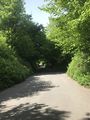
This was fun to ride down
The Twisted Oak pub
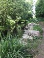
A lovely riverside stop
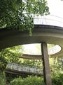
Curly-wurly bridge
Village of Ide
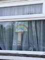
Nice to see support for the NHS

'Private' guess I can't go any further
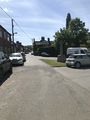
Google, that's a private road
The house with the loud music
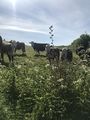
Friendly cows
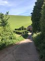
As close as I could get
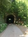
A tunnel! How did I not see this?
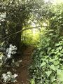
Where might this lead?
Hmm...probably shouldn't go down there
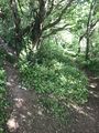
The land I discovered
A stile! Human presence!
'Underfore 1'
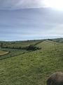
The view from the gate

Stupid grinTM
Looks like an adventure for another day


Achievements
Harowcal earned the No trespassing consolation prize
|