Difference between revisions of "2020-05-18 47 -122"
From Geohashing
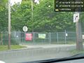
([live picture]hmmm [https://openstreetmap.org/?lat=47.65549800&lon=-122.41395550&zoom=16&layers=B000FTF @47.6555,-122.4140]) |
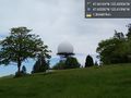
([live picture]view west [https://openstreetmap.org/?lat=47.65597330&lon=-122.41593270&zoom=16&layers=B000FTF @47.6560,-122.4159]) |
||
| Line 32: | Line 32: | ||
Image:2020-05-18_47_-122_thomcat_1589828100937.jpg|hmmm [https://openstreetmap.org/?lat=47.65549800&lon=-122.41395550&zoom=16&layers=B000FTF @47.6555,-122.4140] | Image:2020-05-18_47_-122_thomcat_1589828100937.jpg|hmmm [https://openstreetmap.org/?lat=47.65549800&lon=-122.41395550&zoom=16&layers=B000FTF @47.6555,-122.4140] | ||
| + | |||
| + | Image:2020-05-18_47_-122_thomcat_1589828245078.jpg|view west [https://openstreetmap.org/?lat=47.65597330&lon=-122.41593270&zoom=16&layers=B000FTF @47.6560,-122.4159] | ||
</gallery> | </gallery> | ||
Revision as of 18:57, 18 May 2020
| Mon 18 May 2020 in Seattle: 47.6610369, -122.4292634 geohashing.info google osm bing/os kml crox |
Location
In Discovery park, possibly on the roof of building in the treatment facility.
Participants
Plans
Lunchtime visit, shortly after noon
Expedition
Tracklog
Photos
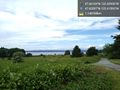
No road access @47.6539,-122.4133
hmmm @47.6555,-122.4140
view west @47.6560,-122.4159


