Difference between revisions of "2020-05-19 47 -122"
From Geohashing
([live picture]area [https://openstreetmap.org/?lat=47.76393030&lon=-122.24137240&zoom=16&layers=B000FTF @47.7639,-122.2414]) |
([live picture]driveway? [https://openstreetmap.org/?lat=47.76390230&lon=-122.24210110&zoom=16&layers=B000FTF @47.7639,-122.2421]) |
||
| Line 40: | Line 40: | ||
Image:2020-05-19_47_-122_thomcat_1589923524205.jpg|area [https://openstreetmap.org/?lat=47.76393030&lon=-122.24137240&zoom=16&layers=B000FTF @47.7639,-122.2414] | Image:2020-05-19_47_-122_thomcat_1589923524205.jpg|area [https://openstreetmap.org/?lat=47.76393030&lon=-122.24137240&zoom=16&layers=B000FTF @47.7639,-122.2414] | ||
| + | |||
| + | Image:2020-05-19_47_-122_thomcat_1589923668968.jpg|driveway? [https://openstreetmap.org/?lat=47.76390230&lon=-122.24210110&zoom=16&layers=B000FTF @47.7639,-122.2421] | ||
</gallery> | </gallery> | ||
Revision as of 21:27, 19 May 2020
| Tue 19 May 2020 in 47,-122: 47.7638043, -122.2414042 geohashing.info google osm bing/os kml crox |
Location
Participants
Plans
Expedition
Tracklog
Photos

accuracy @47.7640,-122.2413

geohasher @47.7639,-122.2414
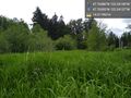
area @47.7639,-122.2414
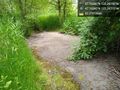
driveway? @47.7639,-122.2421


Achievements