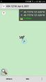
2021-04-06 43 -121

| Tue 6 Apr 2021 in 43,-121: 43.7723746, -121.6260530 geohashing.info google osm bing/os kml crox |
Location
Across the road from Fall River campground in Deschutes National Forest.
Participants
- Frogman
- Kate
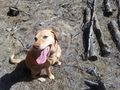
- Daisy
Expedition
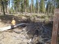
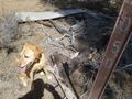
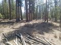
This was a pretty short and easy expedition. I hadn't driven stick shift in around four years and, knowing that I might be borrowing my parent's truck next month, decided that this nearby hashpoint would be a great chance to get some practice. The mom and the dog were happy to come along! We parked on National Forest road 4240 (which OpenStreetMap calls "Lookout Mountain Road") and headed off on a rougher side road, which we stayed on until fairly close to the hashpoint. The hashpoint itself was at the site of what appeared to be a controlled burn. Some burnt logs were stacked up nearby. We snapped some pictures and continued walking for a while longer -- it was a nice day!
Photos
The side road (and dog)
Dog
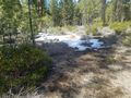
Dog and snow
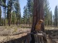
Dog and stump
We made it!
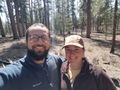
Goofy grins
Nearby road and recreational parking lot
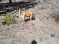
Dog
Dog
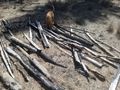
Some burnt wood (and dog)


