Difference between revisions of "2021-09-19 50 8"
| Line 1: | Line 1: | ||
| − | + | {{meetup graticule | |
| − | |||
| − | |||
| − | |||
| − | |||
| − | |||
| − | |||
| − | |||
| − | |||
| lat=50 | | lat=50 | ||
| lon=8 | | lon=8 | ||
| date=2021-09-19 | | date=2021-09-19 | ||
| − | }} | + | }} |
| + | |||
__NOTOC__ | __NOTOC__ | ||
== Location == | == Location == | ||
| − | + | In the woods near Königstein. | |
== Participants == | == Participants == | ||
| − | + | * [[User:Mampfred|Mampfred] | |
| − | + | * [[User:LadyBB|LadyBB] | |
| + | * [[User:EmmJay|EmmJay] | ||
| + | * A couple of drag-along friends | ||
== Plans == | == Plans == | ||
| − | + | We wanted to meet up anyway so we decided to meet up near the hash and do some other stuff before and after. | |
== Expedition == | == Expedition == | ||
| − | + | What we didn't really take into account was the "Eschborn-Frankfurt" bike race on the day. Because of that, several roads in the area were closed for pretty much half the day. Thankfully we all made it to the designated parking area just before the roads got closed off and we only stood for about 10 minutes in the traffic jam on the way back after the closures. So -- timing is everything :) | |
| − | + | We found the hash somewhere in the woods along our walking tour and also did a couple of geocaches. All in all, we had a lovely day in the area. | |
| − | |||
== Photos == | == Photos == | ||
| − | |||
| − | |||
| − | |||
<gallery perrow="5"> | <gallery perrow="5"> | ||
| + | Image:2021-09-19_50_8_starting_out.jpg | Group collecting itself | ||
| + | Image:2021-09-19_50_8_naturpark_taunus.jpg | This is where we started | ||
| + | Image:2021-09-19_50_8_coordinates_reached.png | Coordinates reached | ||
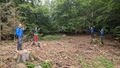
| + | Image:2021-09-19_50_8_not_geocaching.jpg | Looking for the hash? Harhar. | ||
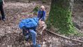
| + | Image:2021-09-19_50_8_tree_stump_fun.jpg | Stupid group tree stump grin | ||
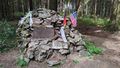
| + | Image:2021-09-19_50_8_monument.jpg | A little monument we found not far from the hash | ||
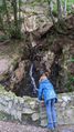
| + | Image:2021-09-19_50_8_waterfall.jpg | And a waterfall a little further | ||
</gallery> | </gallery> | ||
== Achievements == | == Achievements == | ||
{{#vardefine:ribbonwidth|800px}} | {{#vardefine:ribbonwidth|800px}} | ||
| − | |||
| − | |||
| − | |||
| − | |||
| − | |||
| − | |||
| − | |||
| − | |||
| − | |||
| − | |||
| − | |||
| − | |||
| − | |||
| − | |||
[[Category:Expeditions]] | [[Category:Expeditions]] | ||
| − | |||
[[Category:Expeditions with photos]] | [[Category:Expeditions with photos]] | ||
| − | |||
| − | |||
| − | |||
| − | |||
| − | |||
[[Category:Coordinates reached]] | [[Category:Coordinates reached]] | ||
| − | |||
| − | |||
| − | |||
| − | |||
| − | |||
| − | |||
| − | |||
| − | |||
| − | |||
| − | |||
| − | |||
| − | |||
| − | |||
| − | |||
| − | |||
| − | |||
| − | |||
| − | |||
Revision as of 08:11, 15 October 2021
| Sun 19 Sep 2021 in 50,8: 50.1906191, 8.4397067 geohashing.info google osm bing/os kml crox |
Location
In the woods near Königstein.
Participants
- [[User:Mampfred|Mampfred]
- [[User:LadyBB|LadyBB]
- [[User:EmmJay|EmmJay]
- A couple of drag-along friends
Plans
We wanted to meet up anyway so we decided to meet up near the hash and do some other stuff before and after.
Expedition
What we didn't really take into account was the "Eschborn-Frankfurt" bike race on the day. Because of that, several roads in the area were closed for pretty much half the day. Thankfully we all made it to the designated parking area just before the roads got closed off and we only stood for about 10 minutes in the traffic jam on the way back after the closures. So -- timing is everything :)
We found the hash somewhere in the woods along our walking tour and also did a couple of geocaches. All in all, we had a lovely day in the area.
Photos
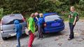
Group collecting itself
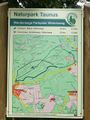
This is where we started

Coordinates reached
Looking for the hash? Harhar.
Stupid group tree stump grin
A little monument we found not far from the hash
And a waterfall a little further


