2022-02-20 41 1
| Sun 20 Feb 2022 in Tarragona, Catalonia: 41.4836540, 1.7821973 geohashing.info google osm bing/os kml crox |
Location
Behind a field -vineyard- in Piera, Anoia, Catalonia.
Participants
Plans
Bike there then to Masquefa. If I am tired, take the train back home from there, if not and I have time, bike back to Martorell where I will take the train.
Expedition
In other circumstances it's doubtful I would have gone after this hash, but since I had to be confined in a room at home for almost 2 weeks, I was really longing for the outside and was certain I would take Frühlingskiefer out this weekend, and this hash was the perfect challenge to discover a new area.
Prepared the route at home, parts I already know until a certain point where I would deviate. Weather was supposed to be perfect, sunny and right under 20ºC so it was all prepared. Almost forgetting it, I wanted to check the orography of the area. Satellite imagery suggest behind a field but what looks like a forest. I chech a topographic map and... ups, there is a almost 20m height difference between the end of the field and the hash. Well, now I am hyped up I will check it personally.
Woke up relatively early to have the whole morning and no having to rush. Slightly cold but it can only get warmer from here. Bike part was smooth and not too challenging. Landscapes where very beautiful. The vineyards were not that green but the almond-trees are starting to blossom and pink clouds decorated the path here and there. Found a few geocaches and then went after the hash.
I arrived at the field, went to the very end and along the way I saw that on the other side the cliffs were kind of scary... Was checking how close I got, 30m, and taking a consolation picture when I notice that over there it was not THAT bad. Maybe I can get closer...
...and so started a new chapter on my constant odyssey on "how dense is the mediterranean undergrowth?". I was lucky I was wearing long sleeves and mike bike helmet. I had to literally crawl, full belly on the ground, to go through and at this point I was not getting a no as an answer. I finally reached the spot where the GPSr showed only 1m to destination. Quick photo as proof, relief sigh and back up.
After that I cycled to Masquefa. There passes a train every hour. The plan was that if I had to wait to much, I would cycle a bit more to the next station, or the other, but since the wait was not that long, and I saw the opportunity to rest, I ended my bike journey there.
Transferred trains in Martorell and back home with no more history to be told.
Tracklog
Photos
Beautiful side-view of Montserrat mountain.
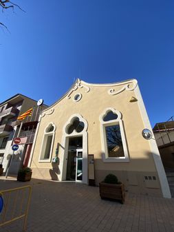
City hall of Sant Llorenç d'Hortons.
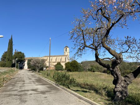
Church of Sant Llorenç d'Hortons.
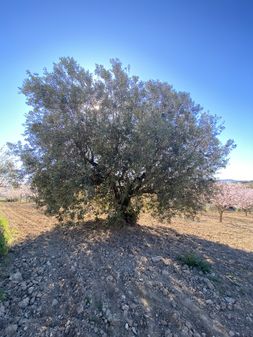
Magnificent Olive tree. Behind are some blooming almonds.
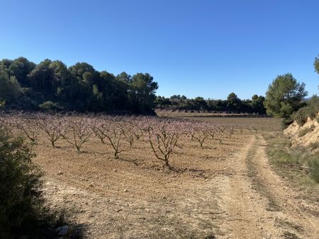
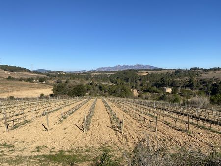
After this blooming almond field was the vineyard I was aiming for.
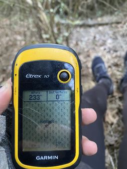
0m to hash! :) No place to stand.
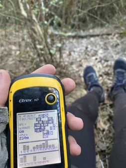
Coordinates reading. Inside the +-6m uncertainty.
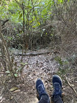
Hashpoint with hashers feet.
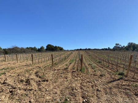
Vineyard next where the hash fell.
Reaching Masquefa to end my journey.


Achievements
SastRe.O with Frühlingskiefer earned the Bicycle geohash achievement
|
Other Geohashing Expeditions and Plans on This Day
Expeditions and Plans
| 2022-02-20 | ||
|---|---|---|
| Melbourne East, Australia | Rwh | Off Vic Oak Track in the hills above Marysville. |
| Tarragona, Spain | SastRe.O | Behind a field -vineyard- in Piera, Anoia, Catalonia. |
| Portland, Oregon | Michael5000, Jim | At the side of a vacant lot in Beaverton. |
| Kassel, Germany | Digiphono | On a grass verge between two fields north of Hoya-Hägerhof |
| Birmingham, United Kingdom | Dan Q | Outside a warehouse full of sheet aluminium, Kitts Green Road, Birmingham. |
| Hannover, Germany | DLichti, Fippe, Deneko | located in the fields near Isernhagen. |