Difference between revisions of "Main Page"
imported>1PE (→2014) |
imported>1PE m (→2014) |
||
| Line 46: | Line 46: | ||
This section documents hash expeditions that geohashers ''wish'' they could make, but have not been able to for the reasons stated. | This section documents hash expeditions that geohashers ''wish'' they could make, but have not been able to for the reasons stated. | ||
===2014=== | ===2014=== | ||
| − | *[[2014-12-22 33 130]] Near the top of a mountain about 500m west of the [http://www.pacificgolf.co.jp/daihakata/ Daihakata Country Club] in Chikushi district, Fukuoka Prefecture, Japan. But, you would be ''over the tunnel'' for the [http://en.wikipedia.org/wiki/Shinkansen Shinkansen] (Bullet Train).[[User:1PE|1PE (Canberra)]] ([[User talk:1PE|talk]]) 20:04, 21 December 2014 (EST) | + | *[[2014-12-22 33 130]] Near the top of a mountain about 500m west of the [http://www.pacificgolf.co.jp/daihakata/ Daihakata Country Club] in Chikushi district, Fukuoka Prefecture, Kyushu, Japan. But, you would be ''over the tunnel'' for the Kyushu [http://en.wikipedia.org/wiki/Shinkansen Shinkansen] (Bullet Train).[[User:1PE|1PE (Canberra)]] ([[User talk:1PE|talk]]) 20:04, 21 December 2014 (EST) |
*[[2014-11-26 global]] In a [http://goo.gl/maps/x54Zt farmer's field], about 10km south of Tal Abyad (Arabic: تل أبيض Tal Abyaḍ; Kurdish: Girê Sipî), a Syrian town located along the Balikh River within the Ar-Raqqah Governorate, and a further 2km from Akçakale in Turkey. Apart from the farmers, this might be a troubled place to be. [[User:1PE|1PE (Canberra)]] ([[User talk:1PE|talk]]) 17:01, 25 November 2014 (EST) | *[[2014-11-26 global]] In a [http://goo.gl/maps/x54Zt farmer's field], about 10km south of Tal Abyad (Arabic: تل أبيض Tal Abyaḍ; Kurdish: Girê Sipî), a Syrian town located along the Balikh River within the Ar-Raqqah Governorate, and a further 2km from Akçakale in Turkey. Apart from the farmers, this might be a troubled place to be. [[User:1PE|1PE (Canberra)]] ([[User talk:1PE|talk]]) 17:01, 25 November 2014 (EST) | ||
*[[2014-09-23 global]] In the coastal national park/forest about 15km north-east of Bintulu, in Sarawak, East Malaysia. It's only several hundred metres from the palm oil plantation roads. Bintulu has the largest single gas manufacturing complex in the world, with a significant 'expatriate' population, so there are potentially many nerdy geohashers.[[User:1PE|1PE (Canberra)]] ([[User talk:1PE|talk]]) 21:42, 22 September 2014 (EDT) | *[[2014-09-23 global]] In the coastal national park/forest about 15km north-east of Bintulu, in Sarawak, East Malaysia. It's only several hundred metres from the palm oil plantation roads. Bintulu has the largest single gas manufacturing complex in the world, with a significant 'expatriate' population, so there are potentially many nerdy geohashers.[[User:1PE|1PE (Canberra)]] ([[User talk:1PE|talk]]) 21:42, 22 September 2014 (EDT) | ||
Revision as of 01:06, 22 December 2014
Welcome to the Geohashing Wiki. Geohashing was brought to you by the xkcd webcomic. Read this information in ![]() Deutsch -
Deutsch - ![]()
![]()
![]() Español -
Español - ![]() Français -
Français - ![]() Svenska - and maybe other languages.
Svenska - and maybe other languages.
| “ | I was astonished to find that it was only a block away from my cousin's house, which I'd probably been to four or five times! How could I have missed a giant glacial erratic boulder in such proximity? I had to investigate, so I began to take my leave.
|
” | |
| find some more great geohashing quotations here. | —OtherJack, commenting on 2014-03-12 47 -122
| ||
What is this?

Geohashing is an adventure, comprising journeys to random places within a given area. Every day, effectively random locations are generated by an algorithm that achieves randomness using stock market data. It is a Spontaneous Adventure Generator. A set of coordinates is generated for each 1°×1° latitude/longitude zone (known as a graticule) in the world. The coordinates can lie anywhere in the graticule — in the forest, in a city, on a mountain, or even in the middle of a lake! Everyone in a given region gets the same set of coordinates relative to their graticule.
The generated coordinates are used as destinations for adventures, à la Geocaching, or for local meetups. After the fun, please document your expedition! The rest of us would love to read your story, see your photos, and cheer your success (or commiserate with your failure). You can use this wiki to document the daily coordinates (geohashes) you’ve been to or tried to reach.
Learn more
How to geohash:
- Beginner's guide - start here
- Guidelines to follow
- Frequently asked questions
- Map applications that may help you get there
- Geohashing guides on various topics
Other people's expeditions:
- geohashing.win - browse all expeditions on a map
- Hall of Amazingness
- Maps and statistics
Get involved
- Find a geohash using a coordinate calculator
- Find others in your local area
- Chat on Discord or IRC #geohashing chat on slashnet (web interface)
- Create your user page and become a part of the community!
news archive • Edit What's new on the wiki?
- The N-in-a-row achievement has been added.
- The renaming process for the MNIMB, MNB, and Virgin Graticule achievements/consolation prizes is ongoing.
- The most active graticule for 2024-03 was -37,145.
- The Birds of a Feather achievement and White Rabbit consolation prize have been added.
More pages needing discussion • Discussion archive • Edit Now discussing - please join in:
- Make sure to check out and give your thoughts on the Proposed achievements!
- For more general discussions, find us here:
- IRC: #geohashing on irc.slashnet.org
- Discord: discord.gg/BvRfGat
Official xkcd meetups

Based on the title text from the comic that established geohashing, the "official" meetup day was interpreted as being Saturday; that is, the day one would have the best chance of meeting others -- see also Mouseover Day. Additionally it was decided through convention that a good meeting time would be 16:00 local time (4:00 P.M.)¹
However, neither of these are hard rules, and they were formulated at a very different early stage in the sport's history. Nowadays and for quite awhile actually, any date or time can be good (or bad, depending on how many other hashers are near you) for meeting up, especially if prearranged. Note that this only applies to that day’s normal local geohash or globalhash coordinates, if you try to go to an alternate location without telling anyone else, it's highly unlikely you'd meet up with a hasher there (obviously).
¹Or earlier if that would be too close to sunset during the winter, or other quirks of temporal tradition; see your local graticule page for consensus there.
Recent and Upcoming Coordinates
The coordinates for the next Saturday meetups, scheduled for 20 April 2024, will be based on the Dow’s opening price published at 09:30 EDT (13:30 UTC) on Friday 19 April. See timeanddate.com to convert this time to your local time zone.
- Coordinates: Thu 18 Apr* | Wed 17 Apr | Tue 16 Apr | Mon 15 Apr | Sun 14 Apr | Sat 13 Apr | Fri 12 Apr | Thu 11 Apr
* Only known for regions east of 30W longitude. Coordinates for regions to the west announced 13:30 UTC, 18 April. - View expedition archives for: April 2024 | March 2024 | February 2024 | More...
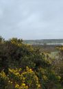
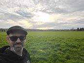
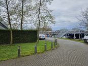
Gallery of Recent Expeditions
The gallery for each day is added to this page automatically, but pictures are selected to the gallery by us. Any geohasher is welcome to add a picture from that day. Just add your image name in the list at the “add yours” link. If the gallery hasn't been started yet, copy the format from the previous day, or read the how-to. Please also write an account of your expedition, even if only a short one, so that people can click the link on your picture and find out more.
Click here to learn how to add your own expedition pictures.
If your newly added expedition does not show, click here to refresh the cache
Click here to see an automatic list of all recent expeditions, whether pictures were posted or not.
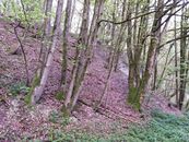
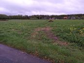
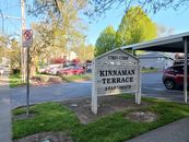
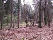
| Recent Expeditions | |||||||||
|
| |||||||||


Recent non-expeditions
This section documents hash expeditions that geohashers wish they could make, but have not been able to for the reasons stated.
2014
- 2014-12-22 33 130 Near the top of a mountain about 500m west of the Daihakata Country Club in Chikushi district, Fukuoka Prefecture, Kyushu, Japan. But, you would be over the tunnel for the Kyushu Shinkansen (Bullet Train).1PE (Canberra) (talk) 20:04, 21 December 2014 (EST)
- 2014-11-26 global In a farmer's field, about 10km south of Tal Abyad (Arabic: تل أبيض Tal Abyaḍ; Kurdish: Girê Sipî), a Syrian town located along the Balikh River within the Ar-Raqqah Governorate, and a further 2km from Akçakale in Turkey. Apart from the farmers, this might be a troubled place to be. 1PE (Canberra) (talk) 17:01, 25 November 2014 (EST)
- 2014-09-23 global In the coastal national park/forest about 15km north-east of Bintulu, in Sarawak, East Malaysia. It's only several hundred metres from the palm oil plantation roads. Bintulu has the largest single gas manufacturing complex in the world, with a significant 'expatriate' population, so there are potentially many nerdy geohashers.1PE (Canberra) (talk) 21:42, 22 September 2014 (EDT)
- 2014-08-29 31 35 Drive or walk along the mostly deserted (no buildings) Kadish Luz Street, West Jerusalem. The hash is beside a pipe access cover. 1PE (Canberra) (talk) 23:49, 28 August 2014 (EDT)
- 2014-08-29 global An easy walk from a road in the western United States. Unfortunately, it's in Montana, and I have commitments in California, so I couldn't make it there in time for midnight even if I had a car at hand. Codae (talk)
- 2014-08-27 28 77 In the outskirts of Delhi, India, at the rear of an upmarket country estate house in the Dera Mandi district. I'd love to knock on that door./gate.1PE (Canberra) (talk) 00:16, 27 August 2014 (EDT)
- 2014-04-30 49 -2 This was pretty much on the beach, on the island of Sark! It's unusual enough for the Channel Islands to be hit at all, but a beach (or small boat) hash on Sark is something else. Wish I could have been there. Macronencer (talk) 08:10, 2 May 2014 (EDT)
- 2014-02-18 52 4 THE place to waste your time [1] On the dock of the bay no less. But, the restricted part of the naval base. JwB (talk)09:52, 18 February 2014 (CET)
- 2014-01-30 Global Hash [2] 28N 126E South China Sea, north-west of Okinawa. I have a friend sailing through this area at the moment, about 240km South East so perhaps two days sail from this GH. However, there is no chance of 'diverting' him today. Hence, no chance of various achievements (he is capable of navigating by compass AND sextant, has a cat onboard the yacht to pat, etc.) A pity! 1PE (Canberra) (talk) 17:30, 29 January 2014 (EST)
- 2014-01-11 -34 149 [3] ON the south-bound track of a bendy bit of the Melbourne, Australia to Sydney, Australia main train line, near Gunning, New South Wales (west of / in the graticule of Goulburn, Australia) -- SOMEONE must be on a train! 1PE (Canberra) (talk) 18:09, 10 January 2014 (EST)
2013
- 2013-12-03 39 -84 Cincinnati, OH. Smack on the tarmac of Lunken Airport. Almost epic enough to justify the police record. Humbucker (talk) 14:15, 3 December 2013 (EST)
- 2013-11-27 global globalhash, Mongolia is about 1km off a dirt road around 10km north of Tosontsengel, Mongolia and it has an airport.1PE (Canberra) (talk)
- 2013-10-25 global GlobalHash in Spain, 48 km from Ponferrada, 113 km from León, 210 km from Salamanca, 366 km from Madrid --LeslieHapablap (talk) 09:57, 24 October 2013 (EDT)
- 2013-07-12 41 -6 (GlobalHash) by 1PE - northern Portugal, just off the N220 east of the village of Carvalhal, itself east of Torre de Moncorvo. Even do-able from Spain: Salamanca or Zamora.
- 2013-07-04 34 35 by 1PE - Syria! Near a major road intersection, in an olive grove.
- 2013-03-28_39_-76 by OfficeLinebacker - In some woods near a river near Conowingo, MD. Already went to two today, don't feel like driving another 4 hours. Looks nice and very reachable, though.
- 2013-03-20 33 72 (GlobalHash) by 1PE - Western side of the Indus River valley, about 25km south of Nowshera, Pakistan; only 60km from Pashawar.
- 2013-03-15 -34 149 by 1PE - very near an interesting Google Maps feature, an aircraft pictured in flight but I couldn't justify going 70km each way to the hash.