User talk:Fippe
Contents
- 1 First Geohash
- 2 Upcoming Global Hash
- 3 Regional maps
- 4 Hi from Sourcerer
- 5 Moving graticule articles
- 6 You surprised me
- 7 Thanks for activity
- 8 Active/Inactive graticules
- 9 Thanks for the hashcard
- 10 Helgoland
- 11 Illinois/Wisconsin?
- 12 Visit to Israel
- 13 Your location template
- 14 Fix the Map
- 15 Hello
- 16 Location tags...
- 17 Facebook Page?
- 18 FippeBot is too fast
- 19 FippeBot in Rostock
- 20 Misc messages
- 21 Thanks for the hashcard!
- 22 Fippebot documentation
- 23 Re: Talk:2020-11-27 47 11
- 24 Administrator access
- 25 Wiki change of item indicator?
- 26 Graticule Symbol Grid
First Geohash
Congratulation for your first geohash!
Greetings --Q-Owl (talk) 14:40, 17 February 2015 (EST)
Thank you! Hopefully, there will be many more. --Fippe 15:14, 17 February 2015 (EST)
Upcoming Global Hash
2017-10-16 global: is this good for you? --GeorgDerReisende (talk) 21:21, 13 October 2017 (UTC)
Regional maps
I've seen you've recently created the map of visited graticules for Slovakia. I wanted to do the same with Spain, but prefered to know before doing it by hand if there's any tool already made to do it automatically. Thanks in advance. Gormaz (talk) 21:25, 8 August 2018 (UTC)
- I created Spain. As far as I am aware there is no tool, but I have a (pretty bad and not universal) script that did most of the copy-pasting. Hopefully I did not make too many mistakes, but if you find any, feel free to correct them. --Fippe (talk) 09:47, 9 August 2018 (UTC)
Hi, I run a notification script on both Twitter and IRC. I have currently put your username on the ignore list since the number of page creations is a bit high. If anyone else is planning on creating a lot of pages, please let me know or use a bot account (my script does ignore creations that are marked as bot creations).--Eupeodes (talk) 09:20, 10 August 2018 (UTC)
- Okay, thanks for letting me know. --Fippe (talk) 09:23, 10 August 2018 (UTC)
Hi from Sourcerer
Hello - I've noticed you making quite a lot of wiki corrections, all of which make sense too! Keep up the good work. It's appreciated. --Sourcerer (talk) 16:05, 10 August 2018 (UTC)
Moving graticule articles
Hey, I want to change the naming of the graticules on the Canary Islands so they're called after the island they are in. Is it enough to use the move button on top of the page or would I be breaking anything? Gormaz (talk) 14:45, 13 August 2018 (UTC)
- There are a few additional things that you should do. (1) You should change the names here too. (2) You should redirect the graticule "shortcut" to the new name. For example, 29,-13 redirects to Teguise, Spain currently, but should redirect to the new name afterwards. (3) You should also change the name on the graticule page itself, and on the graticule pages that surround the graticule. You can find a list of pages that link to Teguise here. --Fippe (talk) 19:24, 13 August 2018 (UTC)
You surprised me
So I saw that you want to have a Palestine page. While I will leave all of my opinions about the Palestinian Authority out of this discussion, I do not believe that any of my hashpoints were in Palestine. There were no Palestinian police officers or soldiers there though I did see Israeli soldiers. There was no Palestinian currency used there even though on many of the trips I bought things in New Israeli Shekels. The only identification I needed to travel to these locations was my Israeli one which allowed me to enter the State of Israel. I can allow you to call the areas under A and B Palestine because there the Palestinian Authority has control (this is the best map for that: https://www.btselem.org/map). In light of these facts, nobody has successfully been at a geohash in any point that could be called Palestine according to the modern definition. Now if you want to start fighting wars before 1948 then this site is going to have to figure out what to do with Dutch East India. Yosef (talk)
Thanks for activity
Hey Fippe Thanks for your activity with geohashing. I recogniced your changes - you changed my home graticule from active to inactive. I don't agree with that change. Because I don't want to agree. But unfortunately it's correct, my last log was about three years ago. Hope I can change the activity state of that graticule soon...:-) GreezBrocorb (talk) 08:14, 16 August 2018 (UTC)
- Aw man, I'm sorry. Go geohashing soon, if you can, and change it back to active! :-) --Fippe (talk) 09:16, 16 August 2018 (UTC)
Active/Inactive graticules
Hi,what is your definition of active and inactive graticules? I saw you changed several Dutch graticules to inactive, including the one I live in and the one I hashed in 6 days ago. And there are more Dutch graticules that do have recent expeditons by locals, and are now set to inactive by you.--Eupeodes (talk) 08:14, 16 August 2018 (UTC)
- Yes, that was a mistake, I apologize. My definition of "inactive" was "no expeditions since 2017-01-01". Often I did not check the Meetup category but just looked at the graticule page. But even there mistakes are not impossible. My thought process was that if I was going to do mistakes it would be okay, since if the graticule is active, a local geohasher would correct me. Thank you for doing so! I double-checked the Dutch graticules (this time using the meetup categories) and hopefully corrected all mistakes. --Fippe (talk) 09:16, 16 August 2018 (UTC)
- I have been recording expedition reports in a database since 2014 (for use in my irc bot on #geohashing and my twitter bot on @geohashing) and I have just made and export for you available here. --Eupeodes (talk) 09:34, 16 August 2018 (UTC)
- First of all, thanks again for your hard work. However, I think we could benefit from a unique criteria regarding the definition of inactive. You seem to be using 'no expeditions on the current and last year' as definition, which I don't have any reason to oppose, but Category:Active graticules states clearly that a graticule is inactive after six months without any expedition. It seems a small period of time, which probably made for sense when Geohashing was more popular, but I'll suggest discussing a new definition to avoid working for nothing. Gormaz (talk) 11:58, 16 August 2018 (UTC)
- Ah, you are right. I did not see the definition, I thought there was none. The six-month rule would make 123 graticules inactive, one of them being Texel which Eupeodes seems to object. But I can leave that one out since Eupeodes is "indicating a continued intention to geohash there" (quote from Category:Active graticules).
- However, before I'll make 122 edits I would prefer that there is a discussion and a consensus. As for my own opinion, I would say it should not be more than "no expeditions on the current and last year". It should also not be less than "no expeditions in the last six months". I would agree to both of those or anything in between. There does not even have to be any change at all, like I said: I only made up a definition because I did not know we had one. --Fippe (talk) 12:30, 16 August 2018 (UTC)
- On Category:Inactive graticules the definition also contains 'and no significant wiki edits, such as planning, commenting or adding names of local users' That could also mean that any graticule where someone active in the community lives is an active graticule (independent of the hashing success in the graticule). And otherwise I should just make more reports of hashes that are impossible to reach without a boat (and buy a sea-worthy boat to go to the hashes.--Eupeodes (talk) 12:38, 16 August 2018 (UTC)
- So, summarizing, we have to make two decisions: 1) after what period of inactivity something becomes officially inactive and 2) whether or not consider only graticule activity or other things like it being home to an active geohasher; right?
- I think there should be a bot that adds/replaces the inactive graticule category if the graticule page has not been modified by a non-bot user for X days. It will save Fippe a lot of work. On the other way, any user may change the category back to active when editing the page for any reason. -- Malgond (talk) 20:14, 17 August 2018 (UTC)
- Now that the issue is well defined (I think), may be we should move the discussion some place more people is likely to see it or, at least, lead them here. Gormaz (talk) 06:57, 17 August 2018 (UTC)
- I found an old discussion at Category_talk:Active_graticules#Active.2FInactive_Definition. Continue there?--Eupeodes (talk) 07:01, 17 August 2018 (UTC)
- So, summarizing, we have to make two decisions: 1) after what period of inactivity something becomes officially inactive and 2) whether or not consider only graticule activity or other things like it being home to an active geohasher; right?
- On Category:Inactive graticules the definition also contains 'and no significant wiki edits, such as planning, commenting or adding names of local users' That could also mean that any graticule where someone active in the community lives is an active graticule (independent of the hashing success in the graticule). And otherwise I should just make more reports of hashes that are impossible to reach without a boat (and buy a sea-worthy boat to go to the hashes.--Eupeodes (talk) 12:38, 16 August 2018 (UTC)
It seems like there has not been any further discussion. Thus, the old definition of active = "activity in the last six months or someone intends to geohash there" remains the new one. I will soon change the categories of the graticules accordingly. --Fippe (talk) 14:10, 6 September 2018 (UTC)
- Thank you very much for your hard work and sorry for not having contribute any more to the discussion :/ Gormaz (talk) 19:57, 17 September 2018 (UTC)
Thanks for the hashcard
Vielen Dank für die nette Karte.
Thanks for the hashcard you send me from 2018-09-07 52 9. I was surprised at first, but that's what you get when you reach couch potato achivement, everybody knows were you live. It´s good to know that there are nice stalkers on the internet :-)
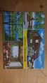
Front
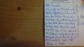
Back


--chemluth (talk) 20:38, 15 September 2018 (UTC)
- You're welcome! I was hoping that you wouldn't take it the wrong way, and am very glad it arrived. :-) --Fippe (talk) 17:13, 16 September 2018 (UTC)
Helgoland
Congrats on your tour to Helgoland (just read your interesting story) to rape this graticule's virginity! Well planned and well done - my respect! Greetz from --Digiphono (talk) 23:40, 3 December 2018 (UTC)
- Thank you! :D I hope you meant reap, since I was not trying do do something against Helgoland's wishes. --Fippe (talk) 08:17, 4 December 2018 (UTC)
Illinois/Wisconsin?
Looks like we were born in the same graticule... did you grow up there too? Or do you have no memory of it? -- OtherJack (talk) 02:44, 24 January 2019 (UTC)
- Yes, I was born in near the south-west corner of that graticule, in a Chicago suburb. I've lived there for my first three years, but have no real memories from that time. Some of my family still lives there though, and sometimes I visit. --Fippe (talk) 07:36, 24 January 2019 (UTC)
Visit to Israel
Cool seeing that you're coming. How can we send private messages on this site so I can give you my contact information? In other news I grew up in southern Lake County, Illinois also in the Chicago suburbs. Yosef (talk) 10:26, 26 February 2019 (UTC)
- I used Special:EmailUser to send you an email, hopefully it reached you. --Fippe (talk) 11:05, 26 February 2019 (UTC)
Your location template
The location template with the car ID KB leads to Nordrhein-Westfalen, but should lead to Landkreis Waldeck-Frankenberg. --GeorgDerReisende (talk) 10:09, 10 April 2019 (UTC)
{{location|NW|KB}}should not be used, since there is no KB district in Nordrhein-Westfalen, so the template defaults to Nordrhein-Westfalen. What should be used is{{location|HE|KB}}, since Landkreis Waldeck-Frankenberg is in Hessen. I fixed it on the expedition page. --Fippe (talk) 18:14, 10 April 2019 (UTC)
This is an interesting project. I noticed you added a template to my hashpoint in Serbia - thanks. I'll add this template to my future expeditions and perhaps re-edit my older ones. The template seems to accept three numbered parameters and city. I think I understand how this works as I've written a few templates. I wonder if you could add a few more examples to the documentation to show how these parameters are used. I nearly added this myself but was not confident that I'd get it right. Good Work! Thanks! Sourcerer (talk) 05:35, 8 June 2019 (UTC)
- Thank you, I'm glad you like it. :-)
- The example section on template:location indeed is not detailed, but there are more examples available for each country where subdivisions are defined, for example template:location/GB#Examples. I added Find more examples for your country at your country's location template to the example section of the template:location.
- Or did you already see template:location/GB#Examples and more examples should be added? If so, please tell me which area should be featured in the example section.
- Side note: Not all parameters are needed for all countries. For lots of countries I defined only one (not two) levels of sudivisions, and thus they only take the abbreviations for the country and the subdivision, e.g. Switzerland. Others, like Poland have two levels of subdivisions defined and thus take three parameters (country, subdivision of level 1, subdivision of level 2). Germany currently is the only country requiring the
cityparameter, because some district abbreviations are used twice: For example, the city of Osnabrück does not belong to the surrounding rural district of Osnabrück, but both use OS as an abbreviation. --Fippe (talk) 08:32, 8 June 2019 (UTC)
- Something like this perhaps ...
{{location|XX|YY|ZZZ|city=MyCity}}- This template takes up to four parameters.
- The first is a two letter country code which must be included - Check out the ISO 3166-1 alpha-2 codes.
- The next parameters are optional. They subdivide the country into regions.
- Each country has its own template and regions documented at location templates.
- The optional city is used like this ...
- EXAMLE HERE PLEASE Sourcerer (talk) 04:07, 9 June 2019 (UTC)
- On Template:Location, it currently says the following:
- "For countries, use ISO 3166-1 alpha-2 codes. This template regards anything a country that is assigned such a code. Use
XIfor international waters. For some countries, you can also tag subdivisions or even subsubdivisions. See the templates in Category:Location templates for countries where these codes are defined and how to use them."
- "For countries, use ISO 3166-1 alpha-2 codes. This template regards anything a country that is assigned such a code. Use
- And in the example section, it says:
- "Find more examples for your country at your country's location template."
- My intention by that was to explain that you have to use the country code, and if you want to go further and tag subdivisions and subsubdivisions, look at the subtemplate for the respective country. I thought that it may be too confusing to put all of that in the documentation for the general template, and I still think that it would be especially confusing to mention the city parameter, which is never used outside of Germany, but it seems that the documentations for the subtemplates are difficult to find. Perhaps this could be solved if the above quote is highlighted, perhaps in bold. What do you think? --Fippe (talk) 15:00, 9 June 2019 (UTC)
- On Template:Location, it currently says the following:
Fix the Map
You seem to have good wiki skills. Have you thought about repairing the broken Google Maps. We might need to crowd-source some funds to pay for a map key or use OpenStreetMap instead. The only problem with volunteering and demonstrating skills is people always ask you to do more :) Sourcerer (talk) 05:43, 8 June 2019 (UTC)
- The "for development purposes only" warning on Google Maps has been bothering me too, I think your suggestion to switch to OpenStreetMap is better than buying an key. The easiest way is probably to just embed geohashing.info (OSM) instead of carabiner.peeron.com (Google). The former is maintained by Eupeodes, and he'd need to be okay with this and change an HTTP header in order for us to be able to embed the page.
- I checked out template:meetup graticule, which is used to embed the map. It seems to happen through a parser function,
#tag:map. (MediaWiki doesn't allow users to embed any webpage with<iframe>, probably a good thing.) I don't think we can edit those by ourselves, this is something requiring an admin. Those are quite difficult to reach, we are still waiting for an answer on the HTTPS issue since last September. --Fippe (talk) 08:35, 8 June 2019 (UTC)
Hello
Hello to you too! :3 Omnimusician (talk) 19:25, 3 May 2019 (UTC)
Location tags...
Hi Fippe. You've added a location tag to one of our old expeditions- thanks (I think?). I didn't come across them in the old templates, are they new, or where are they documented? {{location|MT|16}} implies to me it is in the country Malta, but I've no idea what the 16 could be...
- You are correct, MT is for Malta, and 16 (in combination with MT) is the ISO code for Għasri. The location tag added the Category:Expeditions in Għasri to your expedition.
- This is documented at Template:Location/MT. For general information and information specific to tags for other countries, see Template:Location and Category:Location templates. --Fippe (talk) 21:38, 8 June 2019 (UTC)
Facebook Page?
Geohashing does not have a Facebook page. Should I make one? The chat at #geohashing on mibbit is rarely used these days. Sourcerer (talk) 04:29, 9 June 2019 (UTC)
- If you are on Facebook, sure, I have no problem with it. Not sure how much other geohashers would participate though (I wouldn't, as I am not active there) --Fippe (talk) 15:02, 9 June 2019 (UTC)
- OK - Thanks. I've asked the same question on the main page talk to see if there's any opposition to the idea. I ignored Facebook for ages until I discovered some really useful groups (for me). These include plant and animal identification and obscure groups related to specific hardware used in amateur radio.
FippeBot is too fast
Hey Fippe,
your bot is too fast. I just was creating a page and while saving it, I had an edit conflict. Please let your bot work after I have successfully created the expedition report.
--GeorgDerReisende (talk) 11:13, 16 July 2019 (UTC)
- It is okay to overwrite the bot's change in case of an edit conflict (like you did), just use your version. The bot can then re-tag the location later. Is this okay for you? --Fippe (talk) 13:19, 16 July 2019 (UTC)
- I think I found a better solution. Once implemented, the bot will not tag any expeditions in Category:New report, unless the expedition has been in this category for more than 7 days (some reports have been "new" for years). Is this better? --Fippe (talk) 13:36, 16 July 2019 (UTC)
Thanks for creating a couple of my old expedition pages for me (I would have gotten to them eventually :P ). I think this is great adding additional location info on the pages. I needed a kick in the butt to write up those expeditions (I tend to procrastinate further if I don't write things up right away). However, please leave the New Report category on my expeditions. I use this category to make it easier to find my expeditions that I still need to add pictures to. Once I add those, I remove that category. Pedalpusher (talk) 23:48, 16 August 2019 (UTC)
- Okay, I will leave the category on your expeditions when they do not have images. --Fippe (talk) 11:54, 17 August 2019 (UTC)
FippeBot in Rostock
Hey Fippe. So far your Bot is very well behaving according to Asimov's Laws. However I noticed it marked this expedition 2009-08-21_54_12 as HRO instead of LRO (Rostock != Landkreis Rostock). In case it needs a little twitch for other expeditions in this area ;) --SastRe.O (talk) 11:53, 13 August 2019 (UTC)
Thank you! The bot bases the location on the result from OSM Nominatim. Sometimes Nominatim has some mistakes, I think it happens when the nearest OSM node near given coordinates are not in the same district as the coordinates. However, this was not the case for this mistake. It turns out that the OSM relation for LRO was named "Rostock", the same name that the relation for HRO has. So I renamed the LRO relation on OSM from "Rostock" to "Landkreis Rostock", I hope that fixes the mistake. --Fippe (talk) 21:21, 13 August 2019 (UTC)
Misc messages
Thanks for the instructions! Rincewind (talk)
You're welcome. Glad I could help network! - Jiml (talk)
Thank's for your welcome message to me. Meanwhile I made a Displaced origin geohash and today my second normal geohash - hope, many more will follow - Woodstock68 (talk)
Thanks for the hashcard!
That was a pleasant surprise! More praise here. --DanQ (talk)
Fippebot documentation
Would you mind updating Fippebot's userpage with the things that fippebot does? I don't have any concerns, but I'm curious. Or like a link to its github repo? McKay (talk) 23:46, 22 May 2020 (UTC)
- I will compile a list of things FippeBot does and put it on it's user page, yes. I'd prefer to not publish the code because I am a bit afraid that it may be injectable. Of course, security by obscurity is a bad idea and it would be better to publish so that the public can find bugs, but in this case I don't think the community is large enough to do so. --Fippe (talk) 20:31, 23 May 2020 (UTC)
- I added User:FippeBot#Tasks. --Fippe (talk) 17:18, 3 June 2020 (UTC)
Re: Talk:2020-11-27 47 11
Thanks for the remark. I definitely will claim the musical achievement. --TheOneRing (TheOneRing) 2020-11-28T11:31+01:11
Administrator access
I've just given you administrator access. Thanks for all you do for the wiki! --Dan Q (talk) 08:29, 31 March 2021 (UTC)
Wiki change of item indicator?
I just noticed that my reports no longer have a dot in front of the participants. I suspect the new wiki uses a different markup than a star in column one to do this. Perhaps something for FippeBot to clean up? Jiml (talk) 23:21, 6 April 2021 (UTC)
- The markup did not change, but I think there was a bug in the CSS which did not display lists correctly. I think it is fixed now, at least I cannot see the bug after deleting the site's cache and reloading. Is it fixed for you too? --Fippe (talk) 11:47, 7 April 2021 (UTC)
- Yes - I did a purge on the main page and it is working for me now! Jiml (talk) 15:01, 7 April 2021 (UTC)
Graticule Symbol Grid
Hi Fippe, I wanted to tell you that I admire your productivity, lately you've been a goal for all other geohashers to aspire to. I also admire the section on your user page with the symbols of different graticules you've visited. I tried to implement a similar thing, but being very unskilled with wikis I couldn't figure out how you did it. How would I go about making that grid but with my own pictures to represent my visited graticules? Thanks so much! --DMAJB
- Thank you for the kind words! Your first approach actually was almost correct, I restored that version to your user page, with a small tweak lining up the cells correctly. The main problem was using Template:Symbol, which defines which picture to use for which graticule. Your graticules had not been defined yet, so the template only showed
 this icon. I defined the image files that are supposed to be used for your graticules now, but they are not uploaded yet. File:Danbury, Connecticut.png already is uploaded, but File:Hartford, Connecticut.png and File:Providence, Rhode Island.png are yet to be uploaded. If you do that, they will be shown on your user page. --Fippe (talk) 17:50, 13 May 2021 (UTC)
- That's really useful to know about the symbol templates, thanks to you I was able to upload an image for a graticule I just visited today that hadn't had a symbol yet. Appreciate all of your help, and happy hashing! --DMAJB