2008-10-01 -33 149
| Wed 1 Oct 2008 in Bathurst: -33.3184737, 149.4966839 geohashing.info google osm bing/os kml crox |
Contents
[hide]Location
The hash was roughly twenty metres from the road, on the side of Mount Rankin.
Attendees
- Ephphatha
- T
- Tiger
Report
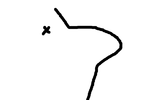
Initially this hash looked fairly easy. Having just started the sport I was excited to finally be able to visit a hash and dragged along my girlfriend and a friend from uni. I didn't have a GPS at this time however, so I drew a very quick and dirty mud map. And we're off.
Drove to this one because I had company, and I was a lazy git :P. It was easy enough until we got to Eglinton. I got lucky and found the right road leaving Eglinton, but missed a turnoff and realised after a while that I had gone too far. We went back to to only corner that looked like my mud map, then gave up and drove back to town.
After I bought a GPS I looked up the hash again on the tool, went back out, found the right road out of Eglinton and missed the turnoff again. The GPS at this point was telling me the hash was 300 metres off the road which I knew to be false, so we took a few pictures and called it a day.
Once I got home I realised that not only had I driven past the turnoff twice, I had incorrectly entered the longitude (halfway through entering the numbers I started reading from the degrees/minutes section instead of pure degrees).


