2009-01-18 50 -118
| Sun 18 Jan 2009 in Mabel Lake, British Columbia: 50.0468092, -118.4906682 geohashing.info google osm bing/os kml crox |
Location
Two kilometers down Strutell Creek Forestry Service Road, halfway between Cherryville and Needles.
Expeditions
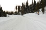
I had been looking forward to winter geohashing, but didn't actually get out until now. It was a relatively easy point in a beautiful area. I packed up with my partner, and enjoyed the scenic drive out there. An hour later I realized I forgot my GPS at home--very disappointing. Due to lack of signage in these areas, I rely on GPS waypoints, and had no idea where to turn. We took a short drive down Kettle River Forestry Service Road, and after admitting it wasn't the right road, headed home.
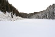
The highlight of the trip was stopping at McIntyre Lake on the way back. I made the very stupid decision to walk partially out on the untested lake. Despite being on a highway, there were no vehicles, no sign of life, just frozen tranquility. I snapped some hand-held photos, but as always, they don't do it justice.


