2009-03-07 -36 144
| Sat 7 Mar 2009 in -36,144: -36.9505124, 144.3216363 geohashing.info google osm bing/os kml crox |
Contents
The location
In a Paddock between Sutton Grange and Mount Alexander
Who Went?
myka
I was contemplating a trip out to the Melbourne East Hashpoint when my dad gave me a call and invited me to a concert at a winery outside Bendigo. I though about it, and then realised that the hash location would end up very close to the concert in the Bendigo Graticule. A chance to see some music and try hashing in my home-town's virgin Graticule!
When I checked it out, it turned out that the hash was literally only a couple of kilometres for the direct route between my Bendigo and the Vinyard, and was near a road. Perfect!
I left Bendigo and started riding out towards the Sutton Grange winery. While these are not exactly major roads I was riding on, there was a fair bit more traffic that normal. Most people were good, but being passed by the occasional bus or semi-trailer when there's no shoulder on the road is a little fun.
Once again, as with all riding I've done in the past week or so, I had a head-wind (Curse you Mother Nature, why are you out to get me so?). It wasn't too strong fortunately, but combined with the pannier I had (overloaded with way more than I actually needed, even considering I'd packed for the concert), riding was slower than expected.
In the region of Sedgwick, I ran into a large Gum tree which I had forgotton was there. This particular tree is an excellent example of a Gum tree which has developed a hollow area in its trunk (there is a term for this). Apart from being used by local Aboriginals in times past, this tree is marked as being a campsite for one of the rescue parties searching for the ill-fated Explorers Burke & Wills. I had forgotten it was there. I took a couple of photos, and while I completely forgot to get a long-shot, I did feel that a shot of my bike inside the tree might give some sense of the scale of the thing. You could sleep 4 or 5 people inside it easily, and the hollow area is well over my height (~6' ish).
The rest of the trip to the hash was mostly pleasant and uneventful, although I had a good time trying out a borrowed GPS (the first of my expeditions I have used one).
After turning off the Sutton Grange Rd, I encountered dirt roads, not exactly ideal for my old hybrid bike with touring tyres really, but the bike managed it.
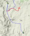
At the end of the last road, and less that 500m from the hash point, I encountered a problem. I just happened to have arrived at the driveway to the property on which the hash was located, and there it was, lurking on the gate... A No Trespassing sign! I doubt it would have been a problem to go in, and there was even a number provided to get permission to do so. But unfortunately, I was running about half an hour late, and thought I still had 10km to ride to the concert, so I gave up and let it be a no-trespassing hash. I thought that was the end of it.
(Also, I need a better way of photographing electronic devices.)
I headed on to the winery by a slightly diferent route than planned, in order to limit the dirt roads the bike was exposed to, and that turned out to be a lucky thing.
Once again Google maps failed me, but not in the usual way... Somehow they managed to get the address of the winery wrong. Not by a little bit, like next door or so, but by a whopping 8km. If I had followed my planned route, I would have missed the winery and kept riding until who knows when. As it was, when I got back to the main road, slightly further down that I left it, I discovered that I could see the event's parking area off in the distance, back in the other direction than I expected. It was a short ride up there, and I arrived just in time for the concert.
Cycled 34.27 km overall.
myka earned the No trespassing consolation prize
|
Ribbons missed due to giving up when it turns out I didn't have to yet... I blame Google:
- Virgin graticule achievement
- Ambassador Geohasher achievement
- Bicycle Geohash Achievement


