2009-06-07 45 -122
| Sun 7 Jun 2009 in Portland, Oregon: 45.4552086, -122.9767424 geohashing.info google osm bing/os kml crox |
Contents
[hide]Location
The hashpoint is located south of Hillsboro, Oregon. It is south of Burkhalter, and north of Farmington Road.
Participants
Plans
It is on farmland, and the owners don't sound receptive to a hashing expedition.
Expeditions
Jim
On Saturday, Jim did an inital survey to see if he could figure out who owned the land we had to cross to get to the hashpoint. I talked to a couple of different folks, neither of which owned the land, but both of which thought we were unlikely to get permission.
On Sunday, Jhon, Jim and 3riador decided on Jenkins Estate, a local park (and nice house and banquet facility) to meet at. Jim arrived a little before 4, and found that the place closed at 4PM. He looped through to check for anyone waiting, and then waited at the entry for folks to show up. 3riador arrived, but before the two could plan anything, like waiting for Jhon, we found someone stuck behind us trying to leave. We drove up the road a ways to plan our strategy.
Jim had failed to grab Jhon's cellphone number, but did look for him as we passed by Jenkins Estate on our way west. But the road was very narrow and twisty and busy, and Jim was afraid of getting locked into Jenkins Estate if we went in.
We had decided to head to the real hashpoint to make one final attempt, since I had noticed one more possible landowner to ask. We found a more likely house, but no one was home. We then went to ask at their (less likely) neighbor, (where a Graduation party was going on) and they said we could walk out along their fence. We got out to the back edge of someone's property, where the crop changed to Austrian peas(I think), and we had to give up. We felt we had reached the land of the "Very unfriendly neighbor"(TM) and did not want to venture any further.
We told the GPS to mark the location, with 0.13 miles to go, and went back to our cars to take our Stupid Grin(TM) photo and head home. (And wonder what happened to Jhon.)
3riador
I got to the alternate location at two minutes to four. Seeing that the gates were about to close, I turned around in the parking lot and realized that Jim was sitting just outside the gate in his car. We decided to make an attempt on the actual hashpoint. After obtaining permission to walk out along a fenceline from the hosts of a graduation party, we made it within a fifth of a mile of the hashpoint but were thwarted by a large field of peas, probably owned by someone who didn't think highly of anyone crossing his land. We marked the point on the GPS and returned to our vehicles. According to the recorded waypoint, we made it to 45°27'23.3" N, 122°58'29.9" W (the point was at 45°27'18.75" N, 122°58'36.27" N). According to Google Maps we made it within about 650 feet of the point.
Jhon
Drove to the alternate location. When he thought he was close, he pulled over to pick up some coffee to aid the trip. It turned out, he was further out than he thought and arrived at the main gate at 4:05. Since the main gate had a large sign noting that the gate closed at 4, he continued on to the secondary entrance. This gate also had a sign that noted it closed at 4, but there were far more people in the parking lot and adjoining playground so he assumed he'd be in at least the same boat as some other people.
Being late, he rushed from his car up to the parking lot closest the alternate meeting point. Seeing no cars in the main parking lots he then traveled as close to the alternate location he could find based entirely on printed maps. Finding noone there, he attempted to call Jim but... turns out he had his work phone number, not cell number... oops!. Jhon took some "proof" photos and journeyed out to the parking lot. Hung out in the parking lot taking photos and then began the trek back to his car. He wound through gardens, up to the gate house, through the herb gardens, past the root cellar and back out to the secondary parking lot.
The gate was not yet closed so Jhon dropped his tripod and gear and, carrying just the camera, ventured around some additional trails. Due to the low light, none of these photos came out particularly well (shouldn't have left the tripod). Jhon then left the Jenkins Estate and headed for the Sushi Restaurant.
At the Sushi place, Jhon enjoyed some delicious Sushi and told the story of the geohash and failed meetup to some fellow sushi-goers. A couple sitting nearby offered to be "Random Sushiland Friends" so at least he met someone on the journey.
Achievements
Jim earned the Meet-up achievement
|
3riador earned the Meet-up achievement
|
Is it true that Jim and 3riador earned the Ambassador achievement?
|
Jim, 3riador, and Jhon earned the No trespassing consolation prize
|
Gallery

Stupid Grin™ showing coordinates of the waypoint we set at our closest approach to the hashpoint.

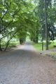
Path from the alternate point back up to the parking lot

Jhon looking cool :p
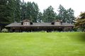
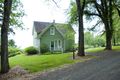
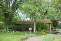
One of the main buildings
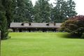
Same building from a slightly better view
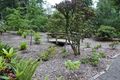
One of the many entrances to the estate garden.

Purdy flowery bush
Bridge over a dry stream

Another flowery bush
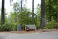
Jhon's geohashing kit on a bench near garden (minus camera)
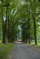
Roadway surrounded by trees.
Same roadway from the gate house
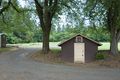
The Gate house
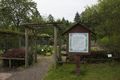
The entrance to the Herb Garden
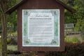
Closeup of the Herb Garden sign
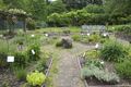
Main square of the herb garden
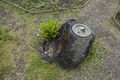
Closeup of the rock in the center of the square
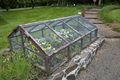
Pretty flowers in a mesh house. I huffed and I puffed but I couldn't blow it down.
The shady herb garden. I decided not to associate with them.
The Root Cellar
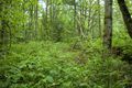
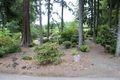
The only photo from wandering the trails that came out.

Exterior of the sushi place

Some salmon pose for a photo with a chef

House Special Roll

California Roll

Spicy Tuna Roll

Random Sushiland Friends


