2009-06-09 49 -123
| Tue 9 Jun 2009 in 49,-123: 49.0174514, -123.0508129 geohashing.info google osm bing/os kml crox |
Contents
[hide]Location
In the swamp(?) just to the west of Boundary Bay Park in Tsawwassen. There appears to be a east-west path mere meters away from the hash point.
This is as far south as you can get in the graticule while still being on the mainland; the border is roughly 2km away.
Participants
yangman who has no GPS but a whole day to waste. Also needs an excuse to do a day ride of 75km+, and this is perfect.
Planning
The location is less than 40km's bike ride from most of core Metro Vancouver.
Getting from Richmond to Ladner is the trickiest since the Massey Tunnel does not allow bikes. However, there are buses that service this route.
For the return trip, there is a bus leaving not too far from the hash point heading to Richmond and Vancouver.
yangman is planning to meet Rhonda at around the hash point at approximately ~14:00 head out after lunch and be near the point in the afternoon, but is willing to push the time back if people want to attempt this after work.
Expedition
Rhonda
I planned out my bus connections, wrote down the co-ordinates, and headed out the door to catch the bus.
Just as I pressed the crosswalk button to cross the last street before reaching the bus stop, with the bus stop in sight, my phone rang.
It was Telus, who needed to get into my building to turn on the internet, something they should have done yesterday. And the tech was standing in front of my building right that minute.
I looked longingly at the bus stop, then sighed and turned my back on the walk signal and headed back home.
yangman
With Rhonda initially committing to arriving at the hash location just before 14:00, I hastily packed a pannier, mounted my GoPro Hero to the bike, and headed out just past noon, hoping to cover the 40km distance in 2 hours' time.
I promptly make a bad turn and end up doing an unnecessary detour in east Burnaby. Things didn't get any better as I entered New Westminster, completely missing my planned route and resulted in having to improvise a route to Pattello Bridge—I blame the Burnaby cycling map not having enough resolution and the New West map being 4 years out of date. By this point, I've already been notified by Xore of Rhonda's unfortunate dropping-out, so the extra 40 minutes of being lost and fixing a minor mechanical were not a concern.
Things went much more smoothly south of the river, and I maintained a good pace through Surrey and Ladner. (As I later found out, the batteries in my bike-mounted camera weren't fully charged, again, and it has stopped recording just north of Ladner.)
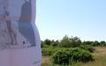
Arriving in Tsawwassen, I made my way to the head of the trail that would theoretically lead me to the hash point. Unfortuantely, all I found after making a couple back-and-forths on Boundary Bay Road was a fence in a very overgrown area. Equipped with nothing but a non-satellite view map of the area and lacking even a basic compass, much less a GPS, I decided the only sensible thing was to see if I could somehow approach the point from the north-eastern side instead.
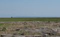
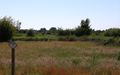
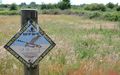
As it turns out, the land between Boundary Bay Regional Park and Boundary Bay Road is a wildlife reserve, and is totally off-limits. Defeated, I took a few photos from somewhere north of the hash point, then returned to the above-mentioned fence for a few more. A crude measurement using Google Maps puts this fence at about 400m to the hash point.
yangman earned the No trespassing consolation prize
|
Return Home
Having already come this far, and never having visited Tsawwassen before, the only logical thing to do is explore the town a little bit, then head over to the 49th parallel for kicks. So that's what I did, right after a panini lunch at a local eatery.
When I was done taking photos of the small obelisks from both side of the border, the clock had just gone past 16:30 and I had just over 60km on the odometer. At this point, I could have called it a day and taken a bus to Richmond or Vancouver, but the opportunity to do my first 100km ride was too good to pass up.
I arrived home shortly after 19:00 with 102.45km on the odometer.
Photos
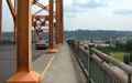
Over the Pattelo
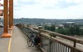
Quick photo break
Under a highway...
I've arrived in Tsawwassen!
Onwards!
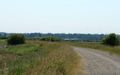
Somewhere north-east of the hash point, I think...
Darn
My map wasn't exactly... precise...
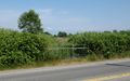
The hash point is east of here, about 400m away
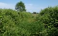
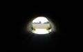
The path over the fence is a little overgrown...
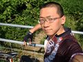
Obligatory (blurry) photo of the hasher
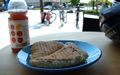
Very, very late lunch
Tsawwassen/Point Roberts border—hey, why not?
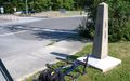
Photo from the Canada side...
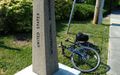
... and from the States side
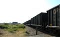
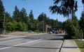
Long train is long. Managed to have to stop for a train at this crossing both going to and coming back from Tsawwassen
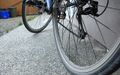
It was a rather dusty trip
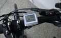
Final distance travelled


Bonus time-lapse video of the first 1/3 of the trip: http://vimeo.com/5089838